
Western Area (Sierra Leone)
| Western Area Western film
|
|
|---|---|
  |
|
| Basic data | |
| Country | Sierra Leone |
| Capital | Freetown |
| surface | 557 km² |
| Residents | 1,500,234 (2015) |
| density | 2693 inhabitants per km² |
| ISO 3166-2 | SL-W |
.jpg) |
|
Coordinates: 8 ° 20 ′ N , 13 ° 9 ′ W
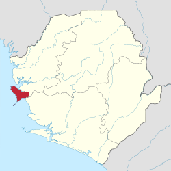
The Western Area is the smallest of the four administrative regions of Sierra Leone . It includes the state capital Freetown with the surrounding lion mountains . It corresponds to the former British Crown Colony in terms of its limits .
The Western Area is divided into the districts Western Area Rural and Western Area Urban . Freetown is the capital of the Western Area and both districts. In contrast to the other three administrative regions Eastern , Northern and Southern , the Western Area is an area and not a province. The western area also includes the island of Tasso and the island group of Banana and Bunce Island . The highest point is Picket Hill at 888 meters.
The area is 557 square kilometers and has 1,500,234 inhabitants.
All ethnic groups in the country are represented in the Western Area. Krio is the most widely spoken language in the area.
Infrastructure
In 2006 the area had 108 health facilities, including twelve government and mission hospitals and two private hospitals. The literacy rate in the Western Area Urban district (urban area of Freetown) was 67.7 percent in 2004 (75.8 percent of men and 59.7 percent of women), well above the national average. 65.8 percent of the children attended school.
See also
Individual evidence
- ^ Sierra Leone - administrative structure. Ministry of Foreign Affairs. Retrieved August 17, 2017.
- ↑ Statistical Digest 2005/06. Statistics Sierra Leone, 2008, p. 2 ( Memento of the original from April 4, 2015 in the Internet Archive ) Info: The archive link was inserted automatically and has not yet been checked. Please check the original and archive link according to the instructions and then remove this notice. accessed on February 24, 2014
- ↑ 2015 Population and Housing Census SUMMARY OF FINAL RESULTS. Statistics Sierra Leone, December 2016.
- ^ Sierra Leone Encyclopedia 2008: Western Area. DACO, no longer online in 2008
- ↑ Statistical Digest 2005/06. Statistics Sierra Leone, 2008, p. 22 ( Memento of the original from April 4, 2015 in the Internet Archive ) Info: The archive link was inserted automatically and has not yet been checked. Please check the original and archive link according to the instructions and then remove this notice. accessed on February 24, 2014
- ↑ Population Profile of Western Area Urban, 2004. Statistics Sierra Leone, 2007/2010, No. 2, p. 58 ( Memento of the original of July 30, 2013 in the Internet Archive ) Info: The archive link was automatically inserted and not yet checked. Please check the original and archive link according to the instructions and then remove this notice. accessed on February 24, 2014
- ↑ Population Profile of Western Area Urban, 2004. Statistics Sierra Leone, 2007/2010, No. 2, p. 57 ( Memento of the original from July 30, 2013 in the Internet Archive ) Info: The archive link was automatically inserted and not yet checked. Please check the original and archive link according to the instructions and then remove this notice. accessed on February 24, 2014