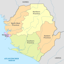
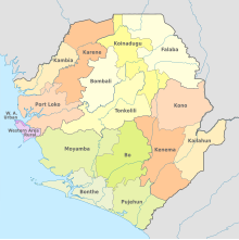
Administrative division of Sierra Leone
The administrative structure of Sierra Leone is based on the Local Government Act, 2004 , the Provinces Act, 2017 and the Local Government Amendment Act, 2017. Sierra Leone has been in four (previously three) provinces and one area since mid-2017, these in turn in districts as well the provinces are also subdivided into chiefdoms ("chiefdoms", i.e. areas of traditional authorities). The provinces are also known as regions .
Each of the provinces is headed by a resident minister (in English , roughly minister present ). His deputy is the provincial secretary. Since the local government reform in 2009, the country has continued to be subdivided into 19 councils, which in turn are divided into 394 wards (departments), each with a council chairman.
City administrations
There are seven municipalities in Sierra Leone (as of 2018):
- Bo - Mayor Harold Tucker ( SLPP )
- Bonthe - Layemin Joe Sandi (SLPP)
- Freetown - Yvonne Aki-Sawyerr ( APC )
- Kenema - Thomas Baio (SLPP)
- Koidu-New Sembehun - Komba Sam ( C4C )
- Makeni - Sunkarie Kamara (APC)
- Port Loko - Abu Bakarr Kamara (APC)
Provinces
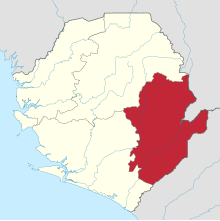
Eastern
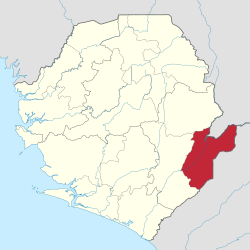
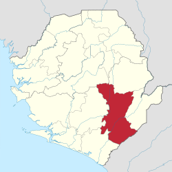
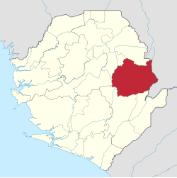
The Eastern province is divided into three districts with 45 chiefdoms. The capital is Kenema .
| District | District Center | Constituencies | Wards | Chiefdom | Chiefdom seat | Area in km² |
Population (2020) |
map |
|---|---|---|---|---|---|---|---|---|
| Kailahun | Kailahun | 10 | 29 | Dea | Baiwala | 3859 | 527.248 |
|
| Jahn | ||||||||
| Njaluahun | Segbwema | |||||||
| Yes how | Daru | |||||||
| Kissi Teng | Kangama | |||||||
| Kissi Tongi | Buedu | |||||||
| Kissi Kama | Dea | |||||||
| Kpeje Bongre | Manowa | |||||||
| Luawa | Kailahun | |||||||
| Malema | Jojoima | |||||||
| You | Mobai | |||||||
| Peje West | Bunumbu | |||||||
| Penguia | Sandar | |||||||
| Upper Bambara | Pendembu | |||||||
| Yawei | Bandajuma | |||||||
| Kenema | Kenema | 11 | 25th | Dama | Giema | 6053 | 609.891 |
|
| Dodo | Dodo | |||||||
| Gaura | Joru | |||||||
| Gorama Mende | Tungie | |||||||
| Kandu-Leppiama | Gbado | |||||||
| Koya | Baoma | |||||||
| Long drama | Baima | |||||||
| Lower Bambara | Panguma | |||||||
| Malegohun | Sembehun | |||||||
| Niawa | Sundumei | |||||||
| Nomo | Faama | |||||||
| Nongowa | Kenema | |||||||
| Simbaru | Boajibu | |||||||
| Small Bo | Blama | |||||||
| Tunkia | Gorahun | |||||||
| Wando | Faala | |||||||
| Kono | Koidu | 9 | 18th | Fiama | Njagbwema | 5641 | 505.174 |
|
| Gbane | Ngandorhun | |||||||
| Gbane-Kandor | Koardu | |||||||
| Gbense | Koidu | |||||||
| Gorama Kono | Kangama | |||||||
| Kamara | Tombodu | |||||||
| Lei | Siama | |||||||
| Mafindor | Kamiendor | |||||||
| Nimikor | Njaiama | |||||||
| Nimiyama | Sewafe | |||||||
| Sandor | Kayima | |||||||
| Soa | Kainkordu | |||||||
| Tankoro | New Sembehun | |||||||
| Toli | Kondewakor |
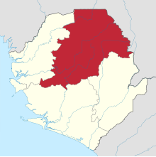
Northern
The province of Northern has been divided into four districts with 55 chiefdoms since mid-2017. The capital is Makeni .
North West
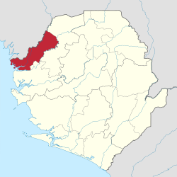
The North West Province is divided into three districts with 34 chiefdoms. The capital is Port Loko .
| District | District Center | Constituencies | Wards | Chiefdom | Chiefdom seat | Area in km² |
Residents (2020) ei |
map |
|---|---|---|---|---|---|---|---|---|
| Cambia | Cambia | 6th | 23 | Bramaia | Kukuna | 3108 | 346.213 |
|
| Dixon | ||||||||
| Gbinle | Tawaya | |||||||
| Khonimakha | ||||||||
| Magbema | Cambia | |||||||
| Mambolo | Mambolo | |||||||
| Masungbala | Kawulia | |||||||
| Samu | ||||||||
| Tala-Munu | ||||||||
| Tonko Limba | Madina | |||||||
| Karene | Kamakwie | 5 | 21st | Buya | 284,807 |

|
||
| Gbanti | ||||||||
| Libeisaygahun-Gombagu | ||||||||
| Mafonda | ||||||||
| Makerembay | ||||||||
| Romende | ||||||||
| Sanda Loko | ||||||||
| Sanda Magbolon Gate | ||||||||
| Sanda tendars | ||||||||
| Safroko Dibia | ||||||||
| Sella Limba | ||||||||
| Tambakha Simibungie | ||||||||
| Tambakha Yobangie | ||||||||
| Port Loko | Port Loko | 3 | 10 | Bureh | Shortage | 5719 | 530.865 |

|
| Kaffu Bullom | Mahera | |||||||
| Kamasondo | ||||||||
| Kasseh | ||||||||
| Koya Masimera | Songo | |||||||
| Lokomasama | Petifu | |||||||
| Maconte Bake-Loko | ||||||||
| Maforki | Port Loko | |||||||
| Makama | ||||||||
| Marampa | Lunsar | |||||||
| Thainkatopa |
Southern
The province of Southern is divided into four districts with 52 chiefdoms. The capital is Bo .
Areas
Western film
The capital of the Western Area is Freetown .
| District | District Center | Chiefdom | Chiefdom seat | Area in km² |
Population (2020) |
map |
|---|---|---|---|---|---|---|
| Western Area Rural | Freetown | no | none | 544 | 444.270 |

|
| Western Area Urban | 13 | 1,055,964 |

|
literature
- Tristan Reed, James A. Robinson: The Chiefdoms of Sierra Leone. Harvard University, Department of Government / Department of Economics, Cambridge 2013. ( available online )
Individual evidence
- ↑ a b c d e Local Government Act, 2004. Government of Sierra Leone, March 1, 2004 ( Memento of the original from February 28, 2014 in the Internet Archive ) Info: The archive link has been inserted automatically and has not yet been checked. Please check the original and archive link according to the instructions and then remove this notice. accessed on February 24, 2014
- ^ The Provinces Act (Cap 60). Government of Sierra Leone, January 30, 2017. ( Page no longer available , search in web archives ) Info: The link was automatically marked as defective. Please check the link according to the instructions and then remove this notice.
- ↑ a b Local Government Amendment Act, 2017. Government of Sierra Leone, June 22, 2017.
- ↑ GOVERNMENT BUDGET AND STATEMENT OF ECONOMIC FINANCIAL POLICIES For the Financial Year, 2018. Government of Sierra Leone, October 27, 2017.
- ^ Sierra Leone unveils new geographical map. Africa Review, July 29, 2017.
- ^ Sierra Leone News: Northerners validate new boundaries. Awoko, July 3, 2017.
- ↑ Sierra Leone now has 190 Chiefdoms and a new national map. Concord Times, August 2, 2017.
- ↑ a b Constituencies Description BD2017. National Electoral Commission, 2017. ( Memento of the original dated November 14, 2017 in the Internet Archive ) Info: The archive link was inserted automatically and has not yet been checked. Please check the original and archive link according to the instructions and then remove this notice. Retrieved November 14, 2017.
- ↑ Local Government Act, 2004. Government of Sierra Leone, March 1, 2004, Section 14, Paragraph 101, p. 51 ( Memento of the original of February 28, 2014 in the Internet Archive ) Info: The archive link has been inserted automatically and has not yet been checked . Please check the original and archive link according to the instructions and then remove this notice. accessed on February 24, 2014
- ↑ Introduction to Country Context. African Health Observatory, date unknown accessed February 24, 2014
- ↑ a b c d e Sierra Leone Census. GeoHive, April 12, 2004 ( Memento of the original from December 12, 2013 in the Internet Archive ) Info: The archive link was inserted automatically and has not yet been checked. Please check the original and archive link according to the instructions and then remove this notice. Retrieved February 19, 2014
- ↑ a b c d population. GoSL Integrated GIS Portal. Retrieved May 14, 2020.
- ^ A b Public notice from the APC national Secretariat in Freetown. The Patriotic Vanguard, October 7, 2017.
- ^ A b New Northern District to be called 'Falaba'. Awoko, May 2, 2017.
