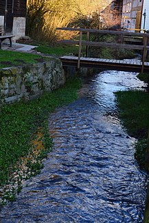
Wichte (Fulda)
| Weights | ||
|
The weights in Neumorschen |
||
| Data | ||
| Water code | DE : 42758 | |
| location | District of Hersfeld-Rotenburg , Schwalm-Eder district , Hesse ( Germany ) | |
| River system | Weser | |
| Drain over | Fulda → Weser → North Sea | |
| source | in the Knüllgebirge at the Rehkopf 51 ° 0 ′ 0 ″ N , 9 ° 36 ′ 2 ″ E |
|
| Source height | approx. 440 m above sea level NHN | |
| muzzle | in Neumorschen in the Fulda coordinates: 51 ° 3 '59 " N , 9 ° 36' 29" E 51 ° 3 '59 " N , 9 ° 36' 29" E |
|
| Mouth height | approx. 175 m above sea level NHN | |
| Height difference | approx. 265 m | |
| Bottom slope | approx. 27 ‰ | |
| length | 9.7 km | |
| Catchment area | 20.2 km² | |
| Left tributaries | Heppenbach, Heidelbach, Hachelbsch, Hundsgraben, Löwengraben | |
| Right tributaries | Löbergraben | |
| Communities | Alheim (district of Licherode ), Morschen (districts of Wichte , Neumorschen ) | |
The Wichte is a 9.7 km long, western and left tributary of the Fulda . It flows through Licherode (part of the municipality of Alheim , in the eastern Hessian district of Hersfeld-Rotenburg ) and through Wichte and Neumorschen (both districts of the municipality of Morschen in the northern Hessian Schwalm-Eder district ).
Its catchment area is 20.2 km² and its discharge rate (MQ) is 142 l / s .
course
The unit weight rises in two approximately 40 meters apart sources at the northwest slope of the 3.5 km south west of Alheimer local part Oberellenbach lying Rehkopfs ( 487.5 m ) to about 440 m above sea level. NHN . The Rehkopf belongs to the Neuenstein-Ludwigsecker mountain range (natural area 357.0), which in turn belongs to the extreme southwest of the Fulda-Werra mountainous region (357) and thus to the Knüllgebirge (Knüll) in the broader sense. The wooden ditch, which also drains into the Fulda, rises on the eastern slope of the Rehkopf .
After about 50 m the two small source streams unite and the Wichte initially runs 1.2 km through a narrow, wooded valley to the north-northwest, then about 1 km to the north west along the edge of the forest to and through Licherode . At the northern end of the village it turns to the northwest, now accompanied on the left by the county road K 66 and continues at the edge of the forest, and after about 800 m takes on the Heppenbach coming from the south on the left. After a further 300 m it flows through an elongated, narrow, approximately 500 m long pond near the former Kohls Mühle, on the left, western bank of which there is a campsite . At the northern end of the pond, at the former Kaisers Mühle, today the Haus Herwig recreation home on the right bank, the brook crosses the district and district boundary, passing under the K 66, which now becomes the district road K 130 in the Schwalm-Eder district and the weight follows on its right bank. The Wichte bends here in a long right curve to the north and north-northeast and after a further 800 m it reaches the confluence of the K 130 into the state road L 3225 coming from the west south of Wichte. There it takes the Heidelbach coming from the west and crosses under the K 130 that ends here to the east.
It runs through Wichte, partially canalized, along the L 3225, at the northern end of the village, changing to the left side of the road and there receiving the Hachelbach flowing from the west. About 50 m after leaving Wichte, the Hundsgraben flow from the west, about 100 m further from the east the Löbergraben and finally after another 200 m from the west the Löwengraben. Now the Wichte turns to the north-northeast and runs, accompanied by the L 3225 on the right, about 2.5 km to Neumorschen. In doing so, it passes the Haus Begmannsruh recreation home (Haus Walter), located to the east on the L 3225, about 1 km northeast of Wichte.
On the southwestern outskirts of Neumorschen, it reaches the Obermühle , which was closed in 1958 , before which a short mill ditch branches off, which joins the stream 400 m further northeast. After about 300 m further flow section through the southern areas of Neumorschen, the Wichte crosses under the L 3225 on the eastern edge of the village, immediately afterwards bends sharply north and then flows another 300 m below the Fulda weir of the Heckenmühle and a few meters south of the Neumorschen with Altmorschen connecting Fulda bridge (L 3225) from the west into the Fulda.
Individual evidence
- ↑ Map services of the Federal Agency for Nature Conservation ( information )
- ↑ a b c d Water map service of the Hessian Ministry for the Environment, Climate Protection, Agriculture and Consumer Protection ( information )
- ↑ For the etymology of the names of the waters, see Albrecht Greule: Deutsches Gewässernamenbuch. De Gruyter, Berlin / Boston, 2014, ISBN 978-3-11-019039-7 , e- ISBN 978-3-11-033859-1 , p. 589.
- ↑ a b c d Electorate of Hesse 1840-1861 - 43. Altmorschen. Historical maps. In: Landesgeschichtliches Informationssystem Hessen (LAGIS).
