Gordon River: Difference between revisions
m →Further reading: +{{Rivers of Tasmania |state=autocollapse}} {{Western Tasmania |state=autocollapse}} |
m →Further reading: +{{GordonPowerDevelopment |state=autocollapse}} |
||
| Line 37: | Line 37: | ||
{{Rivers of Tasmania |state=autocollapse}} |
{{Rivers of Tasmania |state=autocollapse}} |
||
{{Western Tasmania |state=autocollapse}} |
{{Western Tasmania |state=autocollapse}} |
||
{{GordonPowerDevelopment |state=autocollapse}} |
|||
{{coord|42.4356|S|145.5114|E|source:wikidata|display=title}} |
{{coord|42.4356|S|145.5114|E|source:wikidata|display=title}} |
||
Revision as of 07:19, 30 June 2015

The Gordon River is one of the major rivers of Tasmania, Australia. It rises in the centre of the island at Lake Richmond and flows westward for about 193km where it empties into Macquarie Harbour on the West Coast of Tasmania. Major tributaries include the Serpentine River and the Franklin River.
The entire course of the Gordon River is an uninhabited wilderness area. The differentiation between the Upper Gordon River catchment and the Lower Gordon River was made by what were considered impassable gorges - known as the Gordon Splits. Olegas Truchanas was one who was able to travel through these.
Upper Gordon River

The Gordon Dam was constructed to impound the upper reaches of the Gordon River, forming Lake Gordon and the new Lake Pedder for hydro-electric power generation.
Lower Gordon River

Additional dams were proposed for the lower part of the river but the plans were dropped due to changing public opinion. In particular, the Franklin Dam was proposed just downstream of the junction with the Franklin River, and would have flooded much of both rivers. It was a major political and environmental issue in the 1980s.
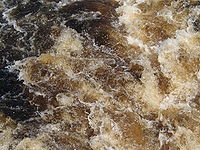
The lower part of the Gordon River is part of the World Heritage area and contains a cold-climate rainforest and rare trees. As with many rivers in western Tasmania, the water is fresh and drinkable, but has the colour of weak tea due to the absorption of tannin from button grass growing in the catchment area.
Boat excursions to the lower Gordon River from Macquarie Harbour are popular with tourists in Strahan. Seaplane flights depart Strahan during the warmer months and include an out landing on the Gordon River (usually a duration of one hour).
See also
References
- Richard Flanagan (1985) A terrible beauty : history of the Gordon River country Richmond, Vic.Greenhouse. ISBN 0-86436-001-0
- Garry Kerr and Hary McDermott (2000) The Huon Pine Story (The History of Harvest and Use of a unique Timber), Portland, Victoria, Mainsail Books, ISBN 0-9577917-0-4.
Further reading
- Gee, H and Fenton, J. (Eds) (1978) The South West Book - A Tasmanian Wilderness Melbourne, Australian Conservation Foundation. ISBN 0-85802-054-8
- Lines, William J. (2006) Patriots : defending Australia's natural heritage St. Lucia, Qld. : University of Queensland Press, 2006. ISBN 0-7022-3554-7
- Neilson, D. (1975) South West Tasmania - A land of the Wild. Adelaide. Rigby. ISBN 0-85179-874-8
