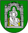
Cinobaňa
| Cinobaňa | ||
|---|---|---|
| coat of arms | map | |

|
|
|
| Basic data | ||
| State : | Slovakia | |
| Kraj : | Banskobystrický kraj | |
| Okres : | Poltár | |
| Region : | Poiplie | |
| Area : | 39.230 km² | |
| Residents : | 2,217 (Dec. 31, 2019) | |
| Population density : | 57 inhabitants per km² | |
| Height : | 288 m nm | |
| Postal code : | 985 22 | |
| Telephone code : | 0 47 | |
| Geographic location : | 48 ° 27 ' N , 19 ° 39' E | |
| License plate : | PT | |
| Kód obce : | 511315 | |
| structure | ||
| Community type : | local community | |
| Structure of the municipality: | 6 parts of the community | |
| Administration (as of November 2018) | ||
| Mayor : | Jozef Melicher | |
| Address: | Obecný úrad Cinobaňa 299 98522 Cinobaňa |
|
| Website: | www.cinobana.sk | |
| Statistics information on statistics.sk | ||
Cinobaňa (until 1927 in Slovak "Cinobáňa" or "Synobáňa"; Hungarian Szinóbánya ) is a municipality in central Slovakia .
location
It is located in the Stolické vrchy on the Cinobaňa brook (Cinobanský potok), 12 km from Poltár and 16 km from Lučenec .
history
The place was first mentioned in 1279 as villa Suine .
In addition to the main town, the municipality also includes Turíčky (incorporated in 1971) and the municipality parts Hrnčiarky , Katarínska Huta , Maša and Žihľava .
The district of Turíčky is one of the possible birthplaces of the Slovak mathematician and cartographer Samuel Mikovíny (* 1686).
Culture
See also: List of listed objects in Cinobaňa
Web links
Commons : Cinobaňa - collection of images, videos and audio files

