České Brezovo
| České Brezovo | ||
|---|---|---|
| coat of arms | map | |

|
|
|
| Basic data | ||
| State : | Slovakia | |
| Kraj : | Banskobystrický kraj | |
| Okres : | Poltár | |
| Region : | Poiplie | |
| Area : | 38.569 km² | |
| Residents : | 464 (Dec. 31, 2019) | |
| Population density : | 12 inhabitants per km² | |
| Height : | 297 m nm | |
| Postal code : | 985 03 | |
| Telephone code : | 0 47 | |
| Geographic location : | 48 ° 29 ' N , 19 ° 48' E | |
| License plate : | PT | |
| Kód obce : | 511340 | |
| structure | ||
| Community type : | local community | |
| Structure of the municipality: | 2 parts of the community | |
| Administration (as of November 2018) | ||
| Mayor : | Ivan Miko | |
| Address: | Obecný úrad České Brezovo č. 97 985 03 České Brezovo |
|
| Website: | www.ceskebrezovo.sk | |
| Statistics information on statistics.sk | ||
České Brezovo (Hungarian Csehberek - until 1907 Csehbrezó ) is a municipality in the southern central Slovakia of Slovakia with 464 inhabitants (December 31, 2019) and belongs to Okres Poltár , a circle of kraj Banskobystrický .
geography
The municipality is located in the western part of the Slovak Ore Mountains in the valley of the Poltarica brook . The center of the village lies at an altitude of 297 m nm and is five kilometers from Poltár and 23 kilometers from Lučenec .
The municipality Vaľkovo has belonged to the municipality since 1973 (until 1927 in Slovak "Válkovo"; Hungarian Válykó ). Zlatno, however, became independent on May 1, 1998 and is no longer part of České Brezovo.
Neighboring municipalities are Kokava nad Rimavicou in the north, Lehota nad Rimavicou in the northeast, Selce in the east, Hrnčiarska Ves in the southeast, Poltár (district Slaná Lehota ) in the south, Uhorské in the west and Krná and Ďubákovo in the northwest. Furthermore, the municipality completely surrounds Zlatno north of the main town, which thus forms an enclave .
history
The place probably originated in the 13th century and was first mentioned in writing in 1435 as Brezow . The first landlords came from the Zach family , later there were members of the Bosnyák and Szentiványi families . In 1828 there were 78 houses and 560 inhabitants who were employed in agriculture and as cooper and wheelwright. In 1836, JG Zahn founded a glass factory in Zlatno, which ended in 2003 (for details see the history section in the Zlatno article ).
Until 1918, the place in Neograd County belonged to the Kingdom of Hungary and then came to Czechoslovakia or now Slovakia.
The name refers to large numbers of birch trees in the area. The adjective "české" (in German Bohemian) refers on the one hand to the stay of Hussites in the area in the 15th century, on the other hand it serves to differentiate from other places called Brezovo (e.g. Rimavské Brezovo and Suché Brezovo ).
population
According to the 2011 census, České Brezovo had 505 inhabitants, 453 of whom were Slovaks and one each Magyar and Czech. 50 residents gave no information in this regard. 188 residents supported the Evangelical Church AB, 174 residents the Roman Catholic Church, four residents the Evangelical Methodist Church and two residents each for the Baptists and the Orthodox Church; four residents professed a different denomination. 57 inhabitants had no denomination and the denomination of 74 inhabitants was not determined.
Buildings
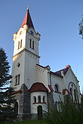
- Protestant church from 1922, designed by the architect Milan Michal Harminc built
traffic
České Brezovo is on the 2nd order road 595 ( Tomášovce –Poltár – Kokava nad Rimavicou) and has a stop on the Lučenec – Utekáč railway line .
Sons and daughters of the church
- Bohuslav Tablic (1769–1832), Slovak poet and Protestant pastor
Individual evidence
- ↑ 2011 census by ethnicity (Slovak) ( Memento from October 6, 2014 in the Internet Archive )
- ↑ 2011 census by denomination (Slovak) ( Memento from September 7, 2012 in the Internet Archive )
Web links
- Entry on e-obce.sk (Slovak)

