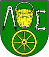
Lehota nad Rimavicou
| Lehota nad Rimavicou | ||
|---|---|---|
| coat of arms | map | |

|
|
|
| Basic data | ||
| State : | Slovakia | |
| Kraj : | Banskobystrický kraj | |
| Okres : | Rimavská Sobota | |
| Region : | Gemer | |
| Area : | 30.066 km² | |
| Residents : | 282 (Dec. 31, 2019) | |
| Population density : | 9 inhabitants per km² | |
| Height : | 273 m nm | |
| Postal code : | 980 53 ( Rimavská Baňa post office ) | |
| Telephone code : | 0 47 | |
| Geographic location : | 48 ° 31 ' N , 19 ° 54' E | |
| License plate : | RS | |
| Kód obce : | 515124 | |
| structure | ||
| Community type : | local community | |
| Structure of the municipality: | 2 parts of the community | |
| Administration (as of November 2018) | ||
| Mayor : | Ivan Antal | |
| Address: | Obecný úrad Lehota nad Rimavicou 134 98053 Lehota nad Rimavicou |
|
| Website: | www.lehotanr.gemer.org | |
| Statistics information on statistics.sk | ||
Lehota nad Rimavicou is a municipality in Slovakia with 282 inhabitants (as of December 31, 2019), which belongs to the Okres Rimavská Sobota , a district of the Banskobystrický kraj .
It is located in the Revúcka pahorkatina mountain range on the Rimavica River, just before the confluence with the Rimava , 20 kilometers from Rimavská Sobota .
It was created in 1957 through the merger of the places Rimavská Lehota (German Lehotta , Hungarian Rimaszabadi ) and Rimavica (German Rimawitz , Hungarian Rimóca ).
Results of the 2001 census (333 inhabitants)
|
By ethnicity:
|
By religion:
|
