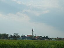
Lenartovce
| Lenartovce | ||
|---|---|---|
| coat of arms | map | |

|
|
|
| Basic data | ||
| State : | Slovakia | |
| Kraj : | Banskobystrický kraj | |
| Okres : | Rimavská Sobota | |
| Region : | Gemer | |
| Area : | 6.830 km² | |
| Residents : | 552 (Dec. 31, 2019) | |
| Population density : | 81 inhabitants per km² | |
| Height : | 155 m nm | |
| Postal code : | 980 44 | |
| Telephone code : | 0 47 | |
| Geographic location : | 48 ° 18 ' N , 20 ° 19' E | |
| License plate : | RS | |
| Kód obce : | 515132 | |
| structure | ||
| Community type : | local community | |
| Administration (as of November 2018) | ||
| Mayor : | Ján Rákoši | |
| Address: | Obecný úrad Lenartovce Hlavná 97 980 44 Lenartovce |
|
| Website: | www.lenartovce.sk | |
| Statistics information on statistics.sk | ||
Lenartovce (1927–1948 Slovak "Linhartovce" - until 1927 "Linkartovce"; Hungarian Sajólénártfalva - until 1907 Lénártfalva ) is a municipality in the south-center of Slovakia with 552 inhabitants (as of December 31, 2019), which is located in the Okres Rimavská Sobota , a district of the Banskobystrický kraj and is counted to the Gemer landscape .
geography
The municipality is located in the southeast of the Rimavská kotlina basin (part of the Juhoslovenská kotlina ) shortly before the Rimava flows into the Slaná , almost directly on the Hungarian border. The center of the village lies at an altitude of 155 m nm and is eleven kilometers from Putnok (H), 17 kilometers from Tornaľa and 29 kilometers from Rimavská Sobota .
Neighboring municipalities are Chanava in the north, Abovce in the northeast, Bánréve and Sajópüspöki (both in Hungary) in the east, Vlkyňa in the south and Číž in the west.
history
The place arose in the 13th century in what was then the area of Chanava and was first mentioned in writing in 1364 as Kishamva . Other historical names are Kishanua (1374), Kis Hanva alias Miklosfalva (1379), Lenarthfalwa (1423) and Lenarthffalwa aliter Kysabaffalwa (1577). Landlords came from the Lenártfalvy families , from the 16th century Abaffy . In 1566 the village was ravaged by the Turks. In 1828 there were 74 houses and 595 inhabitants who were employed in agriculture.
Until 1918/1919, the place in Gemer and Kleinhont counties belonged to the Kingdom of Hungary and then came to Czechoslovakia or now Slovakia. Thus the place called Linkartovce in Slovak at that time became a border town, at the train station on the railway line Bánréve – Fiľakovo a border and customs post was built. Between 1938 and 1944 he was again in Hungary due to the First Vienna Arbitration .
population
According to the 2011 census, there were 543 residents in Lenartovce, including 507 Magyars, 20 Slovaks, eight Roma and one German. Seven residents gave no answer. 366 residents committed themselves to the Roman Catholic Church, 152 residents to the Reformed Church, three residents to the Evangelical Methodist Church, two residents to the Czechoslovak Hussite Church and one resident to the Greek Catholic Church; nine residents professed a different denomination. Three residents were non-denominational and the denomination of 16 residents was not determined.
Individual evidence
- ↑ 2011 census by ethnicity (Slovak) ( Memento from October 6, 2014 in the Internet Archive )
- ↑ 2011 census by denomination (Slovak) ( Memento from September 7, 2012 in the Internet Archive )
Web links
- Entry on e-obce.sk (Slovak)

