Hrušovo
| Hrušovo | ||
|---|---|---|
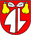
| coat of arms | map | |

|
|
|
| Basic data | ||
| State : | Slovakia | |
| Kraj : | Banskobystrický kraj | |
| Okres : | Rimavská Sobota | |
| Region : | Gemer | |
| Area : | 15.77 km² | |
| Residents : | 176 (Dec. 31, 2019) | |
| Population density : | 11 inhabitants per km² | |
| Height : | 237 m nm | |
| Postal code : | 980 25 | |
| Telephone code : | 0 47 | |
| Geographic location : | 48 ° 31 ' N , 20 ° 3' E | |
| License plate : | RS | |
| Kód obce : | 514926 | |
| structure | ||
| Community type : | local community | |
| Structure of the municipality: | 3 parts of the community | |
| Administration (as of November 2018) | ||
| Mayor : | Ján Sklenár | |
| Address: | Obecný úrad Hrušovo 39 98025 Hrušovo |
|
| Statistics information on statistics.sk | ||
Hrušovo (until 1927 also "Hrušová"; Hungarian Balogrussó - until 1902 Hrussó ) is a municipality in Slovakia .
For 1297 for the first time in writing Huruswa mentioned municipality includes the towns of Ostrany (incorporated in 1960 to Striežovce; German Estring ) and Striežovce (incorporated 1963; German Strisch ).
It was initially under the rule of the Blh Castle , from the 14th century to the Derencsényi family and from the 17th century to the rule of Muráň .
The bell tower from the 1st half of the 18th century and the Protestant church from 1786, rebuilt in 1904 are worth seeing.
