Dulovo
| Dulovo | ||
|---|---|---|
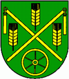
| coat of arms | map | |

|
|
|
| Basic data | ||
| State : | Slovakia | |
| Kraj : | Banskobystrický kraj | |
| Okres : | Rimavská Sobota | |
| Region : | Gemer | |
| Area : | 4.429 km² | |
| Residents : | 261 (Dec. 31, 2019) | |
| Population density : | 59 inhabitants per km² | |
| Height : | 178 m nm | |
| Postal code : | 980 21 (Post Office Bátka ) | |
| Telephone code : | 0 47 | |
| Geographic location : | 48 ° 22 ' N , 20 ° 11' E | |
| License plate : | RS | |
| Kód obce : | 557919 | |
| structure | ||
| Community type : | local community | |
| Administration (as of November 2018) | ||
| Mayor : | Katarína Balážová | |
| Address: | Obecný úrad Dulovo č. 244 980 21 Bátka |
|
| Website: | www.obecdulovo | |
| Statistics information on statistics.sk | ||
Dulovo (until 1927 in Slovak "Dulovec"; in Hungarian Dúlháza - until 1902 Dulháza ) is a small community in southern central Slovakia east of Rimavská Sobota on the Blh River.
It is located in the mountains of the Slovak Ore Mountains and was first mentioned in writing as Dwihaza in 1455 , the name derives from the name of the then owner of the place, Dulo Garanyi .
Until 1918 the municipality in Gemer and Kleinhont County belonged to the Kingdom of Hungary and then came to the newly formed Czechoslovakia . She came back to Hungary for a short time from 1938 to 1945 through the First Vienna Arbitration . After returning to Czechoslovakia, the place was incorporated into the municipality of Bátka from 1964 to 1990 . Since 1993 it has been part of Slovakia.
The place, which used to be inhabited almost entirely by Hungarians, still had around 30% Hungarian-speaking inhabitants, 5% Slovaks and 65% Gypsies in 2001.
Web links
- Entry on e-obce.sk (Slovak)
