
Motorway 12 (Belgium)
| Motorway / Autoroute / Autosnelweg A12 in Belgium | |||||||||||||||||||||||||||||||||||||||||||||||||||||||||||||||||||||||||||||||||||||

|
|||||||||||||||||||||||||||||||||||||||||||||||||||||||||||||||||||||||||||||||||||||
| map | |||||||||||||||||||||||||||||||||||||||||||||||||||||||||||||||||||||||||||||||||||||
.svg) |
|||||||||||||||||||||||||||||||||||||||||||||||||||||||||||||||||||||||||||||||||||||
| Basic data | |||||||||||||||||||||||||||||||||||||||||||||||||||||||||||||||||||||||||||||||||||||
| Operator: | |||||||||||||||||||||||||||||||||||||||||||||||||||||||||||||||||||||||||||||||||||||
| Overall length: | 55 km | ||||||||||||||||||||||||||||||||||||||||||||||||||||||||||||||||||||||||||||||||||||
| Development condition: | 2 × 2 lanes + emergency lanes | ||||||||||||||||||||||||||||||||||||||||||||||||||||||||||||||||||||||||||||||||||||
|
Course of the road
|
|||||||||||||||||||||||||||||||||||||||||||||||||||||||||||||||||||||||||||||||||||||
The Belgian motorway 12 , also on French. Autoroute 12 or Dutch Called Autosnelweg 12 , it runs from the Dutch border at Zandvliet to Brussels . It is briefly interrupted at the Antwerp Ring and ends at the Brussels Ring .

history
As part of a planned direct connection between the ports of Antwerp and Rotterdam , the A12 was already included in the planning at the end of the 1950s. The realization was delayed several times in the 1970s due to investigations of different route variants. Finally, on March 4, 1993, the motorway was fully completed and opened.
gallery
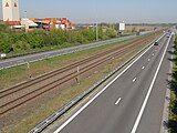
The A12 runs next to the railway line 11

The A12 in the direction of Willebroek


Web links
Commons : A12 - collection of pictures, videos and audio files