Stabroek
| Stabroek | ||
|---|---|---|

|

|
|
|
|
||
| State : |
|
|
| Region : | Flanders | |
| Province : | Antwerp | |
| District : | Antwerp | |
| Coordinates : | 51 ° 20 ′ N , 4 ° 22 ′ E | |
| Area : | 21.51 km² | |
| Residents: | 18,710 (Jan 1, 2019) | |
| Population density: | 870 inhabitants per km² | |
| Post Code: | 2940 | |
| Prefix: | 03 | |
| Mayor: | Rik Frans ( NV-A ) | |
Local government address : |
Gemeentehuis Stabroek Dorpsstraat 99 2940 Stabroek |
|
| Website: | www.stabroek.be | |
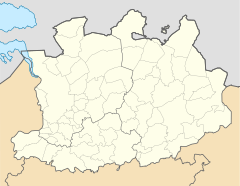
Stabroek is a Belgian municipality in the Flanders region with 18,710 inhabitants (as of January 1, 2019). It is located north of the Antwerp metropolitan area on the edge of the port facilities, about 13 kilometers north of the city center, and borders directly on the Netherlands . In addition to the main town, the municipality also has some smaller districts such as u. a. Heuvels , Hoevenen and Putte .
Brussels is about 54 km south and the Dutch city of Rotterdam a good 62 km north.
The municipality has its own motorway exit ( Stabroek ) on the A12 , which connects Antwerp with Rotterdam . The nearest regional train station is in Kapellen , and national express trains also stop in Antwerp. The Antwerp International Airport and the airport of Rotterdam are the next regional airports and Brussels National close to the capital is an international airport.
Georgetown , the capital of the Republic of Guyana in South America, belonged to the Dutch West Indies from 1783 to 1814 and was named Stabroek after the Antwerp city.
