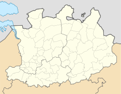
Herselt
| Herselt | ||
|---|---|---|

|

|
|
|
|
||
| State : |
|
|
| Region : | Flanders | |
| Province : | Antwerp | |
| District : | Turnhout | |
| Coordinates : | 51 ° 3 ' N , 4 ° 53' E | |
| Area : | 52.32 km² | |
| Residents: | 14,523 (Jan 1, 2019) | |
| Population density: | 278 inhabitants per km² | |
| Post Code: | 2230 | |
| Prefix: | 013, 014 and 016 | |
| Mayor: | Luc Peetermans ( CD&V ) | |
Local government address : |
Gemeentebestuur Kerkstraat 1 2230 Herselt |
|
| Website: | www.herselt.be | |
Herselt is a Belgian municipality in the Flanders region with 14,523 inhabitants (as of January 1, 2019). It consists of the main town and the district Ramsel.
Turnhout is 30 kilometers north, Antwerp 37 kilometers northwest and Brussels about 42 kilometers southwest.
The next motorway exits are to the north at Herentals and Geel on the A13 / E 313 and south at Aarschot and Tielt-Winge on the A2 .
The nearest regional train stations are in Herentals, Heist-op-den-Berg and Aarschot .
The Antwerp International Airport is the nearest regional airport and the airport Brussels National near the capital Brussels is of international importance.
Personalities
- André Vlayen (1931–2017), racing cyclist
photos
Web links
Commons : Herselt - collection of images, videos and audio files


