Oud turnhout
| Oud turnhout | ||
|---|---|---|

|

|
|
|
|
||
| State : |
|
|
| Region : | Flanders | |
| Province : | Antwerp | |
| District : | Turnhout | |
| Coordinates : | 51 ° 18 ′ N , 4 ° 59 ′ E | |
| Area : | 38.80 km² | |
| Residents: | 13,662 (Jan 1, 2019) | |
| Population density: | 352 inhabitants per km² | |
| Post Code: | 2360 | |
| Prefix: | 014 | |
| Mayor: | Leo Nys ( CD&V ) | |
Local government address : |
Gemeentehuis Dorp 31 1260 Oud-Turnhout |
|
| Website: | www.oud-turnhout.be | |
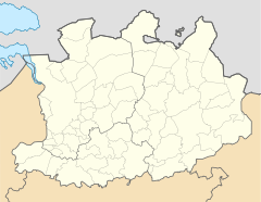
Oud-Turnhout (Alt-Turnhout) is a municipality in the Belgian province of Antwerp . The municipality should not be confused with the neighboring town and municipality of Turnhout to the west .
Nature reserve
In the east of the municipality and possibly with a smaller part also to the east of the municipality is the 500 hectare nature reserve of a peat bog. On April 22nd, 2020 it was reported that a third of the area, i.e. around 167 hectares of forest, was burned. Due to the prolonged drought and therefore the risk of fire, entering the area had previously been prohibited.
Sons and daughters of the church
- Joseph Ignace Waterschoot (1911–1990), Catholic clergyman and Vicar Apostolic of Lolo
- Karel Van Miert (1942–2009), politician
- DJ Coone (actually Koen Bauweraerts) (* 1983), disc jockey and music producer
Web links
Commons : Oud-Turnhout - collection of images, videos and audio files
Individual evidence
- ↑ Large parts of a nature reserve in Belgium are burning orf.at, April 22, 2020, accessed April 23, 2020.
