
Essen (Belgium)
| eat | |||
|---|---|---|---|
_wapen2.svg)
|

|
||
|
|||
| State : |
|
||
| Region : | Flanders | ||
| Province : | Antwerp | ||
| District : | Antwerp | ||
| Coordinates : | 51 ° 28 ′ N , 4 ° 27 ′ E | ||
| Area : | 47.48 km² | ||
| Residents: | 19,038 (Jan. 1, 2019) | ||
| Population density: | 401 inhabitants per km² | ||
| Post Code: | 2910 | ||
| Prefix: | 03 | ||
| Mayor: | Gaston Van Tichelt ( CD&V ) | ||
Local government address : |
Heuvelplein 23 2910 Essen |
||
| Website: | www.essen.be | ||

Essen is a municipality in the Belgian province of Antwerp with 19,038 inhabitants (as of January 1, 2019). The municipality is north of Antwerp, right on the border with the Netherlands . Kalmthout is south of Essen . The next Dutch municipality north of the border is Roosendaal in Noord-Brabant .
Essen is a border station on the Antwerp – Roosendaal railway line , but only local and IR trains stop there.
history
The place name appears as Esschen for the first time in a document from 1146. After 1159 the glory Esschen-Kalmthout was created , which belonged to the Tongerlo Abbey until 1789 . Until the end of the 19th century, Essen was predominantly characterized by agriculture. Essen experienced a strong economic boom when it was connected to the railway network in 1854. Until the 1970s, the veterinary examination of cattle was carried out in Essen . There was therefore a cattle yard at the train station as a quarantine station . Its economy has been linked to the nearby Antwerp port since the beginning of the 20th century.
Events
The Belgian Christmas Beer Festival has been held in Essen since 1999.
Attractions
The Bakkersmolen, the baker's mill, in the Wildert district is worth seeing. The facility consists of a museum with a historic bakery, steam engine and windmill.
Daughters and sons of the church
- Louis Duerloo (1910–1977), racing cyclist
- Arthur Vanderstuyft (1883–1956), racing cyclist
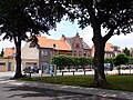
Food (center)

Food (center)

Horendonk

Poachers


Web links
Individual evidence
Aartselaar | Antwerp | Arendonk | Baarle-Hertog | Balen | Beerse | Berlaar | Boechout | Bonheiden | Boom | Bornem | Borsbeek | Brasschaat | Brecht | Dessel | Duffel | Edegem | Food | Geel | Grobbendonk | Heist-op-den-Berg | Hemiksem | Herentals | Herenthout | Herselt | Hoogstraten | Hove | Hulshout | Kalmthout | Chapels | Kasterlee | Kontich | Laakdal | Lier | Lille | Lint | Malls | Mechelen | Meerhout | Merksplas | Mole | Mortsel | Niel | Nijlen | Oils | Oud turnhout | Putte | Puurs-Sint-Amands | Ranst | Ravel | Retie | Rijkevorsel | Rumst | Clamp | Shields | Pods | Sint-Katelijne-Waver | Stabroek | Turnhout | Vorselaar | Vosselaar | Westerlo | Wijnegem | Willebroek | Wommelgem | Wuustwezel | Zandhoven | Zoersel | Zwijndrecht