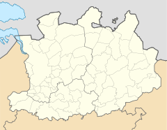
Herentals
| Herentals | ||
|---|---|---|

|

|
|
|
|
||
| State : |
|
|
| Region : | Flanders | |
| Province : | Antwerp | |
| District : | Turnhout | |
| Coordinates : | 51 ° 11 ′ N , 4 ° 50 ′ E | |
| Area : | 48.56 km² | |
| Residents: | 28,177 (Jan. 1, 2019) | |
| Population density: | 580 inhabitants per km² | |
| Height: | 15 m | |
| Post Code: | 2200 | |
| Prefix: | 014 | |
| Mayor: | Jan Peeters ( sp.a ) | |
Local government address : |
Augustijnenlaan 30 2200 Herentals |
|
| Website: | www.herentals.be | |
Herentals is a Belgian city in the Flanders region on the banks of the Albert Canal with 28,177 inhabitants (as of January 1, 2019). It consists of the main town and the districts Morkhoven and Noorderwijk .
Turnhout is 18 kilometers to the northeast, Antwerp 30 kilometers to the west and Brussels about 48 kilometers to the southwest.
traffic
Herentals has three motorway exits on the A13 / E 313 . The municipality has a regional train station on the Antwerp - Lier - Herentals - Mol - Hasselt / Weert ( Netherlands ) (→ Iron Rhine ) railway .
The Brussels-Zaventem airport (42 km southwest) Belgium's largest airport and the Antwerp Airport is the nearest regional airport .
Attractions
- The town hall was built as a Lakenhalle ( Gewandhaus ) around 1400. Part of this building is the belfry from 1590 with a carillon , which is part of the UNESCO World Heritage “Belfries in Belgium and France”.
- The beguinage with a late Gothic church (around 1600), a gatehouse from 1622 and houses from the 17th century was founded in 1266 and housed around 300 beguines in the 15th century. It was badly damaged in the iconoclasm in the 16th century , but was later rebuilt.
Town twinning
Herentals has partnered with
-
 Cosne-Cours-sur-Loire in Burgundy ( France )
 -
 IJsselstein in the province of Utrecht ( Netherlands )
 -
 Alps in North Rhine-Westphalia ( Germany )
sons and daughters of the town
- Peter Memmius (1531–1587), Rector of the University of Rostock
- Frans Peeters (* 1956), marksman
- Paul Herijgers (* 1962), racing cyclist
- Paul Coopmans (1962-2007), Belgian ornithologist
- Johan Verstrepen (* 1967), racing cyclist
- Kurt Van De Wouwer (* 1971), racing cyclist
- Erwin Vervecken (* 1972), racing cyclist
- Mario Aerts (* 1974), racing cyclist
- Geert Omloop (* 1974), racing cyclist
- Bart Wellens (* 1978), racing cyclist
- Roel Moors (* 1978), basketball player and coach
- Hanna Mariën (* 1982), sprinter and bobsleigh athlete
- Jurgen Van Den Broeck (* 1983), racing cyclist
- Gwendoline Horemans (* 1987), volleyball player
- Kaat Hannes (* 1991), racing cyclist
- Wout Van Aert (* 1994), racing cyclist
Web links
Commons : Herentals - collection of images, videos and audio files
Wikisource: Herentals in the Topographia Circuli Burgundici (Mathäus Merian) - sources and full texts

