Vorselaar
| Vorselaar | ||
|---|---|---|

|

|
|
|
|
||
| State : |
|
|
| Region : | Flanders | |
| Province : | Antwerp | |
| District : | Turnhout | |
| Coordinates : | 51 ° 12 ′ N , 4 ° 46 ′ E | |
| Area : | 27.62 km² | |
| Residents: | 7861 (Jan. 1, 2019) | |
| Population density: | 285 inhabitants per km² | |
| Post Code: | 2290 | |
| Prefix: | 03, 014 | |
| Mayor: | Lieven Janssen (ShareV) | |
Local government address : |
Gemeente Vorselaar Market 14 2290 Vorselaar |
|
| Website: | www.vorselaar.be | |
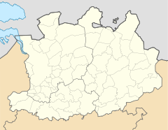
Vorselaar is a Belgian municipality in the Flanders region with 7861 inhabitants (as of January 1, 2019). It is located near the town of Herentals north of the Albert Canal and should not be confused with the nearby municipality of Vosselaar .
Turnhout is 18 kilometers (km) to the northeast, Antwerp 25 kilometers to the west and Brussels about 50 kilometers to the southwest. The next motorway exits are at Herentals on the A13 / E 313 and at Lille and Zoersel on the A21 / E 34 . The nearest regional train stations are in Herentals and Bouwel, a part of the community of Grobbendonk . The Antwerp International Airport is the nearest regional airport and Brussels National close to the capital is an international airport.
Personalities
- Alfons Brijdenbach (1954–2009), track and field athlete
- Cardinal Jozef-Ernest Van Roey (1874–1961), Archbishop of Mechelen
- Edward Sels (* 1941), racing cyclist
Web links
Commons : Vorselaar - collection of images
