
Baarle-Hertog
| Baarle-Hertog | |||
|---|---|---|---|

|

|
||
|
|||
| State : |
|
||
| Region : | Flanders | ||
| Province : | Antwerp | ||
| District : | Turnhout | ||
| Coordinates : | 51 ° 27 ′ N , 4 ° 56 ′ E | ||
| Area : | 7.48 km² | ||
| Residents: | 2760 (Jan. 1, 2019) | ||
| Population density: | 369 inhabitants per km² | ||
| Post Code: | 2387 | ||
| Prefix: | 014 | ||
| Mayor: | Frans de Bont (Forum +) | ||
Local government address : |
Gemeentehuis Kerkstraat 11 2387 Baarle-Hertog |
||
| Website: | www.baarle-hertog.be | ||


Baarle-Hertog ( French Baerle-Duc ) is a Belgian exclave in the Netherlands, administratively part of the Flemish province of Antwerp . On January 1, 2019, Baarle-Hertog had 2760 inhabitants. The total size is 7.48 square kilometers, resulting in a population density of 369 inhabitants per square kilometer.
Borderline
As part of the border town of Baarle , Baarle-Hertog is known for the complicated drawing of the border with Baarle-Nassau in the Netherlands . Baarle-Hertog consists of a total of 24 separate pieces of land. Apart from the main area of Zondereigen north of the Belgian municipality of Merksplas, there are 20 Belgian exclaves within the main Dutch borders and three other areas close to the Dutch-Belgian border. Within the Belgian enclaves there are seven Dutch enclaves , six of them in the largest Belgian area and a seventh in the second largest. An eighth Dutch enclave is in Zondereigen.
The state border runs through some buildings in the city. When the Dutch law required restaurants to be closed earlier than the Belgian law, this was done in border-crossing restaurants in such a way that the affected guests had to move to other tables.
photos

Old town hall Baarle-Hertog
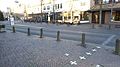
The border between Baarle-Nassau and Baarle-Hertog on the Singel road


Web links
Aartselaar | Antwerp | Arendonk | Baarle-Hertog | Balen | Beerse | Berlaar | Boechout | Bonheiden | Boom | Bornem | Borsbeek | Brasschaat | Brecht | Dessel | Duffel | Edegem | Food | Geel | Grobbendonk | Heist-op-den-Berg | Hemiksem | Herentals | Herenthout | Herselt | Hoogstraten | Hove | Hulshout | Kalmthout | Chapels | Kasterlee | Kontich | Laakdal | Lier | Lille | Lint | Malls | Mechelen | Meerhout | Merksplas | Mole | Mortsel | Niel | Nijlen | Oils | Oud turnhout | Putte | Puurs-Sint-Amands | Ranst | Ravel | Retie | Rijkevorsel | Rumst | Clamp | Shields | Pods | Sint-Katelijne-Waver | Stabroek | Turnhout | Vorselaar | Vosselaar | Westerlo | Wijnegem | Willebroek | Wommelgem | Wuustwezel | Zandhoven | Zoersel | Zwijndrecht