Zoersel
| Zoersel | ||
|---|---|---|

|

|
|
|
|
||
| State : |
|
|
| Region : | Flanders | |
| Province : | Antwerp | |
| District : | Antwerp | |
| Coordinates : | 51 ° 16 ′ N , 4 ° 43 ′ E | |
| Area : | 38.65 km² | |
| Residents: | 21,944 (Jan 1, 2019) | |
| Population density: | 568 inhabitants per km² | |
| Post Code: | 2980 | |
| Prefix: | 03 | |
| Mayor: | Liesbeth Verstreken ( NV-A ) | |
Local government address : |
Administratief Centrum Handelslei 167 2980 Zoersel |
|
| Website: | www.zoersel.be | |
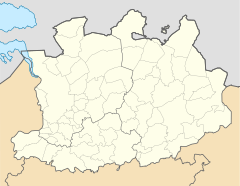
Zoersel is a municipality with 21,944 inhabitants (as of January 1, 2019) in the Flanders region in Belgium . It consists of the main town and the districts of Halle and Sint Antonius and is located in the province of Antwerp a good 20 kilometers northeast of Antwerp .
traffic
The next motorway exits are in the south and east Zoersel , Lille and Ranst on the A21 / E 34 and Massenhoven on the A13 / E 313 as well as Brecht and Sint-Job-in-´t-Goor on the A1 / E 19 in the west. The nearest regional train stations are in Turnhout, Herentals , Lier and Kapellen , and national express trains also stop in Antwerp. The Antwerp International Airport is the nearest regional airport .
Town twinning
-
 Graefenhainichen , Germany (since 2005)
Web links
Commons : Zoersel - collection of images, videos and audio files
