Ravel
| Ravel | ||
|---|---|---|

|

|
|
|
|
||
| State : |
|
|
| Region : | Flanders | |
| Province : | Antwerp | |
| District : | Turnhout | |
| Coordinates : | 51 ° 22 ′ N , 5 ° 0 ′ E | |
| Area : | 94.99 km² | |
| Residents: | 15.009 (Jan. 1, 2019) | |
| Population density: | 158 inhabitants per km² | |
| Post Code: | 2380 (Ravels) 2381 (Weelde) 2382 (Poppel) |
|
| Prefix: | 014 | |
| Mayor: | Walter Luyten ( CD&V ) | |
Local government address : |
Gemeentelaan 60 2381 Ravels |
|
| Website: | www.ravels.be | |
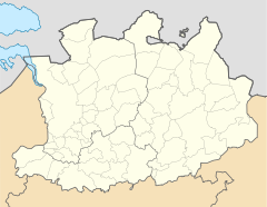
Ravels is a Belgian municipality in the Flanders region with 15,009 inhabitants (as of January 1, 2019). It is located in the north of Belgium and borders directly on the Netherlands . Ravels consists of the main town and the two other districts Poppel and Weelde .
Turnhout is six kilometers south of the capital, the Dutch city of Eindhoven 34 kilometers east, Antwerp 44 kilometers west-southwest and Brussels about 72 kilometers southwest (all information as the crow flies ).
The next motorway exits are at Turnhout and Retie on the A21 / E 34 .
The nearest regional train station is also in Turnhout .
Eindhoven Airport and Antwerp Airport are the closest regional airports and Brussels National near the capital is an airport of international importance.
