Shields (Belgium)
| Shields | ||
|---|---|---|

|

|
|
|
|
||
| State : |
|
|
| Region : | Flanders | |
| Province : | Antwerp | |
| District : | Antwerp | |
| Coordinates : | 51 ° 14 ′ N , 4 ° 35 ′ E | |
| Area : | 35.99 km² | |
| Residents: | 19,652 (Jan 1, 2019) | |
| Population density: | 546 inhabitants per km² | |
| Post Code: | 2970 | |
| Prefix: | 03 | |
| Mayor: | Dirk Bauwens ( NV-A ) | |
Local government address : |
Gemeentehuis Brasschaatsebaan 30 2970 shields |
|
| Website: | www.schilde.be | |
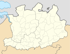
Schilde is a Belgian municipality in the province of Antwerp and has 19,652 inhabitants (as of January 1, 2019). It is located on the eastern edge of the Antwerp agglomeration north of the Albert Canal and includes the districts of Schilde and 's-Gravenwezel .
Antwerp city center is twelve kilometers to the west and Brussels about 45 kilometers to the south. The next motorway exits are Ranst on the A21 / E 34 and Wommelgem on the A13. Antwerp is the closest train station with national train connections and Antwerp Airport is the closest regional airport to the city .
Web links
Commons : Shields - Collection of images, videos, and audio files
