Schwende AI
| AI is the abbreviation for the canton of Appenzell Innerrhoden in Switzerland and is used to avoid confusion with other entries of the name Schwende . |
| Schwende | |
|---|---|
| State : |
|
| Canton : |
|
| BFS no. : | 3105 |
| Postal code : | 9057 |
| Coordinates : | 751014 / 240712 |
| Height : | 838 m above sea level M. |
| Height range : | 771–2502 m above sea level M. |
| Area : | 57.51 km² |
| Residents: | 2196 (December 31, 2018) |
| Population density : | 38 inhabitants per km² |
|
Proportion of foreigners : (residents without citizenship ) |
10.0% (December 31, 2018) |
| Website: | www.schwende.ch |
|
Scattered settlements Schwende and Rüte |
|
| Location of the municipality | |
Schwende is a district in the canton of Appenzell Innerrhoden in eastern Switzerland . The seat of the district administration is in Weissbad .
Names
In the 12th century the name Swendi or swandjan was mentioned. It comes from the old German expression shrinking ( clearing the forest ).
geography
The Schwende district is the largest in the canton. It includes the villages of Schwende and Wasserauen , parts of Weissbad (south of the Brüelbach) and Appenzell (south-west of the Sitter ) as well as the Innerrhoder part of the Säntis Mountains and the Alpstein .
The pre-alpine to alpine terrain between 800 and 1100 meters is covered with scattered agricultural settlements that are inhabited all year round , the highest pastures reach heights (at the upper Mesmer ) of up to 2200 meters. The district area stretches from the Säntis Mountains to Schwende, Weissbad, along the left bank of the Sitter to the village of Appenzell, from there along the right bank of the Chlosbach over the high moor, Wasserschaffen and Scheidegg, Kronberg to the Säntisspitze. It includes most of the Alpstein (689 ha) and also the forest area (1670 ha) of the canton.
The Sax-Schwende-Bruch runs towards Sax .
history

The stone tools made of oil quartzite and radiolarite found in the caves of the Wildkirchli point to summer hunting trips by the Neanderthals to higher altitudes.
The Rhode Schwendi was created between 1204 and 1220 to secure military and tax payments to the Prince Abbey of St. Gallen . The initial Rhods master was later replaced by captains and councilors elected at annual Rhods meetings, who had to represent the Rhodes in the authorities of the old country of Appenzell and, from 1597, in those of Innerrhoden.
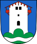
In the village of Schwende there were ruins of a tower next to the parish church until 1830, which was presumably the seat of the Lords of Doppelstein , as Ministeriale of the Abbot of St. Gallen. The Schwendner are said to have destroyed the tower and thus triggered the Appenzell Wars .
The current district was created with the constitution of 1872 from the Rhode Schwendi, which was approved by the Innerrhod voters on November 24, 1872, while the old borders were retained.
Economy and tourism
For a long time, the main occupation was livestock. Hand embroidery was a sideline for women farmers until well into the 20th century . Weissbad (Rietli) with its bathing tourism, which has existed since 1740, became an upscale health resort in the 19th and early 20th centuries .
From the middle of the 19th century tourism developed with mountain inns, which are among the oldest in Switzerland (Gasthaus Aescher-Wildkirchli 1846, Berggasthaus Alter Säntis 1846) and some commercial enterprises. This was facilitated by the road from Appenzell to Wasserauen laid out in 1867-69, the Säntisbahn that opened in 1912 and, since 1955, the Wasserauen-Ebenalp cable car.
Recently, many small businesses in industry, commerce and tourism have opened or settled in the district. The Hotel Hof Weissbad has been successful in the tourism, wellness and health sector since 1994 and, with around 185 employees, is the largest employer in the district. Agriculture is an important economic factor with (still) 52 farms.
population
| year | 1801 | 1850 | 1900 | 1950 | 2000 | 2010 |
| Residents | 799 | 1101 | 1299 | 1410 | 1935 | 2147 |
Personalities
- Johannes Dörig (* around 1490 in Schwende; † 1526 in Hemberg ) was a Catholic pastor and reformer .
Attractions
The pilgrimage chapel of Our Lady in Maple , built in 1937, is near Schwende with a miraculous image from the 17th century.
Below the Ebenalp are the prehistoric caves of the Wildkirchli and the Aescher-Wildkirchli mountain inn .
literature
- Rainald Fischer: The art monuments of the canton of Appenzell Innerrhoden . The Inner Land: Schwende . Birkhäuser AG, Basel 1984, ISBN 3-7643-1629-2 . (= Die Kunstdenkmäler der Schweiz , Volume 74.) pp. 442–448, 498.
Web links
- Official website
- Hermann Bischofberger: Schwende. In: Historical Lexicon of Switzerland .
Individual evidence
- ↑ Permanent and non-permanent resident population by year, canton, district, municipality, population type and gender (permanent resident population). In: bfs. admin.ch . Federal Statistical Office (FSO), August 31, 2019, accessed on December 22, 2019 .
- ↑ Our Inner Rhodes in numbers. (PDF; 1.61 MB) Cantonal Administration of Appenzell Innerrhoden, p. 2 , accessed on December 22, 2019 (population data according to the residents' registration of the canton of Appenzell Innerrhoden).


