
Alma (Quebec)
| Alma | |||
|---|---|---|---|
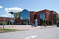
 View of Alma |
|||
.svg) coat of arms |
|||
| Location in Quebec | |||
|
|||
| State : |
|
||
| Province : | Quebec | ||
| Administrative region : | Saguenay – Lac-Saint-Jean | ||
| MRC or equivalent : | Lac-Saint-Jean-Est | ||
| Coordinates : | 48 ° 33 ′ N , 71 ° 39 ′ W | ||
| Height : | 85 m | ||
| Area : | 195.59 km² | ||
| Residents : | 30,904 (as of 2011) | ||
| Population density : | 158 inhabitants / km² | ||
| Time zone : | Eastern Time ( UTC − 5 ) | ||
| Municipality number: | 93042 | ||
| Postal code : | G8B | ||
| Area code : | +1 418 | ||
| Mayor : | Marc Asselin | ||
| Website : | www.ville.alma.qc.ca | ||
 Located in the MRC Lac-Saint-Jean-Est |
|||

Alma is a city in the center of the Canadian province of Quebec . It is located in the administrative region Saguenay-Lac-Saint-Jean , about 200 km north of the provincial capital Québec . The administrative seat of the regional county municipality (municipalité régionale du comté) Lac-Saint-Jean-Est has an area of 195.59 km² and has 30,904 inhabitants (2011).
geography
Alma is about nine kilometers from the east bank of Lac Saint-Jean . This lake, the third largest inland body of water in the province of Québec, has two outflows: La Grande Décharge in the north and La Petite Décharge in the south. Both unite a little east of the city to the Rivière Saguenay , an important tributary of the Saint Lawrence River . The Grande Décharge is dammed by a hydroelectric power station to a lake with several small islands, on the north bank of which are the settlements of Delisle and L'Isle-Maligne. The districts of Naudville and Riverbend are located on Île d'Alma, the 13 kilometer long island between Grande Décharge and Petite Décharge. The actual center of Alma is on the south bank of the Petite Décharge. The terrain near the shore of Lac Saint-Jean is largely flat and gradually changes into slightly hilly terrain east of the city.
Neighboring municipalities are Saint-Henri-de-Taillon in the northwest, L'Ascension-de-Notre-Seigneur in the north, Labrecque in the northeast, Saint-Nazaire in the east, Larouche in the southeast, Saint-Bruno in the south and Saint-Gédéon in the southwest.
history
Damase Boulanger is considered to be the first settler and city founder. From 1856 he lived sporadically by the rapids of the Petite Décharge to oversee the operation of the wooden slide that had been installed there by the paper company Price Brothers . In 1867 he settled permanently with his family. The place name recalls the Battle of the Alma , which took place in 1854 during the Crimean War . The municipality of Saint-Joseph-d'Alma was created in 1879 when it split off from Hébertville . At the beginning, the village was dominated by agriculture. This changed in the 1920s with the construction of a hydroelectric power station, followed by several energy-intensive industrial operations. Due to the rapid industrialization, the municipality of Saint-Joseph-d'Alma received city status in 1924. In 1954 she shortened her name to Alma. In 1962 Isle-Maligne, Naudville and Riverbend were incorporated, followed by the incorporation of Délisle in 2001.
population
According to the 2011 census, Alma had 30,904 inhabitants, which corresponds to a population density of 158.0 inh / km². 98.9% of the population stated French as their main language, the share of English was 0.5%. 0.2% said they were bilingual (French and English), other languages and multiple answers accounted for 0.4%. Only French spoke 84.2%. In 2001, 95.2% of the population were Roman Catholic , 1.4% Protestant, and 2.8% non-denominational.
Economy and Transport
Alma belongs to the world's most important aluminum production region, which also includes the nearby city of Saguenay . The Rio Tinto Alcan Group's plant, located around four kilometers northwest of the city center, produces around 400,000 tons of aluminum annually. Rio Tinto Alcan operates six hydropower plants in the region to meet its high own needs . One of them is located in the city, the Centrale de l'Île Maligne on the Grande Décharge with an installed capacity of 448 MW. The second industrial pillar is wood processing . In addition to the paper mill of Bowater there in Alma including several sawmills, two manufacturers of prefabricated houses and a granule factory. The tourism is actively promoted lately.
Route 169 , which runs around Lac Saint-Jean, runs through the center of Alma . From this branch off other main roads: Route 170 to Jonquière and Saint-Siméon and Route 172 to Chicoutimi and Tadoussac . Long-distance bus company Intercar connect Alma several times a day with Chicoutimi, Dolbeau and Quebec . Four kilometers south of the city center is a small airport with a runway around 1,300 meters long. A railway line runs along the western edge of the city, which is used to transport goods to the aluminum plant.
Town twinning
Personalities
- Lucien Bouchard (* 1938), politician
- Michel Côté (born 1950), actor
- Guillaume Desbiens (* 1985), ice hockey player
- Charles Hudon (born 1994), ice hockey player
- Roch Pedneault (1927-2018), Catholic clergyman, auxiliary bishop in Chicoutimi
- François-Louis Tremblay (* 1980), short tracker
- Mario Tremblay (* 1956), ice hockey player and coach
- Mélanie Turgeon (* 1976), ski racer
photos
library

Saint-Joseph schoolhouse

Isle-Maligne rectory

Former Isle-Maligne Town Hall

Collège d'Alma

Hydroelectric power plant

Paper mill

Aluminum plant

Saint-Joseph-d'Alma church


Web links
- Alma Official Website (French)
- Tourism information (French, English)
Individual evidence
- ↑ Ville d'Alma contribue à corriger l'histoire ( Memento from April 12, 2014 in the web archive archive.today )
- ↑ Alma. Commission de toponymie du Québec, accessed April 12, 2014 (French).
- ↑ Population profile of the municipality of Alma. In: 2011 Census. Statistics Canada , 2011, accessed April 12, 2014 (French).
- ↑ Population profile of the municipality of Alma. In: 2001 Census. Statistics Canada , 2001, accessed April 12, 2014 (French).
- ↑ a b La grande industrie. (No longer available online.) City of Alma, archived from the original on April 13, 2014 ; Retrieved April 12, 2014 (French).
- ↑ Un réseau de six centrales hydroélectriques. (No longer available online.) Rio Tinto Alcan, archived from the original on June 22, 2013 ; Retrieved April 12, 2014 (French).
- ↑ L'offre touristique. (No longer available online.) City of Alma, archived from the original on April 13, 2014 ; Retrieved April 12, 2014 (French).
- ↑ Alma. Canadian Owners and Pilots Association, accessed April 12, 2014 (French).