Route 170 (Québec)
| Route 170 in Quebec, Canada | ||||||||||||||||||||||||||||||||||||||||||||||||||||||||||||||||||||||||||||

|
||||||||||||||||||||||||||||||||||||||||||||||||||||||||||||||||||||||||||||
| map | ||||||||||||||||||||||||||||||||||||||||||||||||||||||||||||||||||||||||||||
| Basic data | ||||||||||||||||||||||||||||||||||||||||||||||||||||||||||||||||||||||||||||
| Operator: | Ministère des Transports du Québec | |||||||||||||||||||||||||||||||||||||||||||||||||||||||||||||||||||||||||||
| Start of the street: |
Saint-Siméon (branch of ( 47 ° 51 ′ N , 69 ° 52 ′ W ) |
|||||||||||||||||||||||||||||||||||||||||||||||||||||||||||||||||||||||||||
| End of street: | 2 km northeast of Métabetchouan – Lac-à-la-Croix (junction from ( 48 ° 26 ′ N , 71 ° 50 ′ W ) |
|||||||||||||||||||||||||||||||||||||||||||||||||||||||||||||||||||||||||||
| Overall length: | 207 km | |||||||||||||||||||||||||||||||||||||||||||||||||||||||||||||||||||||||||||
|
Region : |
||||||||||||||||||||||||||||||||||||||||||||||||||||||||||||||||||||||||||||
|
Course of the road
|
||||||||||||||||||||||||||||||||||||||||||||||||||||||||||||||||||||||||||||
The Route 170 is a state highway ( Route nationale ) of the Canadian province of Quebec and performs administrative regions Capitale-Nationale and Saguenay-Lac-Saint-Jean . It is sometimes referred to as Boulevard du Royaume and Route du Fjord .
Route description
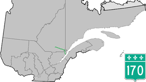
207 km long cross-country road connects the Saint Lawrence River - Estuary location Saint-Siméon with the south shore of Lac Saint-Jean located Métabetchouan-Lac-à-la-Croix . It leads south of the Saguenay Fjord to Saguenay and further south of the Rivière Saguenay to Lac Saint-Jean.
Route 170 initially heads west along the Rivière Noire . It passes the hamlet of Lac-Deschênes and reaches the course of the Rivière Petit Saguenay . It now runs along this in a northerly direction and reaches Petit-Saguenay at km 55, not far from the confluence of the Rivière Petit-Saguenay in the Saguenay fjord. Now the highway turns to the west. It runs south past L'Anse-Saint-Jean and crosses the Rivière Saint-Jean . The hamlets of Rivière-Éternité and Saint-Félix-d'Otis lie along the route. At La Baie (incorporated by Saguenay) the road reaches the bank of the Saguenay Fjord. It runs along the south bank of the Baie des Ha! Ha! . The road then runs past Bagotville Airport, past Chicoutimi south and through central Jonquière . The Autoroute 70 runs in the city of Saguenay for a distance of 35 km north first, then south parallel to Route 170. After the reunification, the Route 170 continues west of Larouche over. Route 169 crosses the road west of Saint-Bruno . Route 170 finally reaches the shores of Lac Saint-Jean. After another 5 km - 2 km northeast of Métabetchouan – Lac-à-la-Croix - it meets route 169 again. This is the end point of the trunk road.
Web links
- Carte routière officielle du Québec
- Ministère des Transports du Québec
- Site officiel des routes touristiques du Québec
