Route 125 (Québec)
| Route 125 in Quebec, Canada | ||||||||||||||||||||||||||||||||||||||||||||||||||||||||||||||||||||||||||||||||||||||||||||||||||||

|
||||||||||||||||||||||||||||||||||||||||||||||||||||||||||||||||||||||||||||||||||||||||||||||||||||
| map | ||||||||||||||||||||||||||||||||||||||||||||||||||||||||||||||||||||||||||||||||||||||||||||||||||||
| Basic data | ||||||||||||||||||||||||||||||||||||||||||||||||||||||||||||||||||||||||||||||||||||||||||||||||||||
| Operator: | Ministère des Transports du Québec | |||||||||||||||||||||||||||||||||||||||||||||||||||||||||||||||||||||||||||||||||||||||||||||||||||
| Start of the street: |
Montréal ( 45 ° 33 ′ N , 73 ° 33 ′ W ) |
|||||||||||||||||||||||||||||||||||||||||||||||||||||||||||||||||||||||||||||||||||||||||||||||||||
| End of street: |
Parc national du Mont-Tremblant ( 46 ° 24 ′ N , 74 ° 16 ′ W ) |
|||||||||||||||||||||||||||||||||||||||||||||||||||||||||||||||||||||||||||||||||||||||||||||||||||
| Overall length: | 133 km | |||||||||||||||||||||||||||||||||||||||||||||||||||||||||||||||||||||||||||||||||||||||||||||||||||
|
Region : |
||||||||||||||||||||||||||||||||||||||||||||||||||||||||||||||||||||||||||||||||||||||||||||||||||||
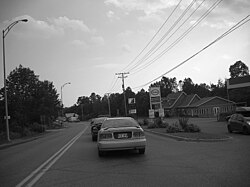
| Route 125 in Sainte-Julienne | ||||||||||||||||||||||||||||||||||||||||||||||||||||||||||||||||||||||||||||||||||||||||||||||||||||
|
Course of the road
|
||||||||||||||||||||||||||||||||||||||||||||||||||||||||||||||||||||||||||||||||||||||||||||||||||||
The Route 125 is a state highway ( Route nationale ) of the Canadian province of Quebec and leads from Montréal on Laval to the north in the Administrative Region Lanaudière and ends at Saint-Donat at the park entrance to the Mont-Tremblant National Park .
Route description
The 133 km long country road begins as a junction of Route 138 in the center of Montréal. It runs through the city in a west-northwest direction as Boulevard Pie-IX . It crosses Autoroute 40 and later runs on Pont Pie-IX over the Rivière des Prairies and reaches Laval. The bridge is subject to a toll. It is popularly named after Pope Pius IX. Called Pont Pie-IX , but has the official name Pont Le Caron. In Laval, route 125 coincides with Autoroute 440 for several kilometers . Route 125 crosses the Rivière des Mille Îles and reaches Terrebonne on the opposite bank of the river. The trunk road runs parallel to the east-running Autoroute 25 in a northerly direction via the town of Mascouche to Saint-Esprit , where the Autoroute ends. Route 125 continues its course north and passes the towns of Sainte-Julienne , Chertsey and Notre-Dame-de-la-Merci . Finally, it reaches the town of Saint-Donat, located in the Laurentine Mountains , and shortly afterwards the park entrance to the Secteur de la Pimbina of the Parc national du Mont-Tremblant provincial park , where it ends.
Web links
- Carte routière officielle du Québec
- Ministère des Transports du Québec
- Site officiel des routes touristiques du Québec
Individual evidence
- ↑ Autoroute 25: Information on the toll. Retrieved April 10, 2012 .

