Route 133 (Québec)
| Route 133 in Quebec, Canada | ||||||||||||||||||||||||||||||||||||||||||||||||||||||||||||||||||||||||||||||||||||||||||||||

|
||||||||||||||||||||||||||||||||||||||||||||||||||||||||||||||||||||||||||||||||||||||||||||||
| map | ||||||||||||||||||||||||||||||||||||||||||||||||||||||||||||||||||||||||||||||||||||||||||||||
| Basic data | ||||||||||||||||||||||||||||||||||||||||||||||||||||||||||||||||||||||||||||||||||||||||||||||
| Operator: | Ministère des Transports du Québec | |||||||||||||||||||||||||||||||||||||||||||||||||||||||||||||||||||||||||||||||||||||||||||||
| Start of the street: |
Sorel-Tracy ( 46 ° 3 ′ N , 73 ° 7 ′ W ) |
|||||||||||||||||||||||||||||||||||||||||||||||||||||||||||||||||||||||||||||||||||||||||||||
| End of street: | US border south of Philipsburg (Saint-Armand) ( 45 ° 1 ′ N , 73 ° 5 ′ W ) |
|||||||||||||||||||||||||||||||||||||||||||||||||||||||||||||||||||||||||||||||||||||||||||||
| Overall length: | 132 km | |||||||||||||||||||||||||||||||||||||||||||||||||||||||||||||||||||||||||||||||||||||||||||||
|
Region : |
||||||||||||||||||||||||||||||||||||||||||||||||||||||||||||||||||||||||||||||||||||||||||||||
|
Course of the road
|
||||||||||||||||||||||||||||||||||||||||||||||||||||||||||||||||||||||||||||||||||||||||||||||
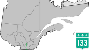
The Route 133 (also Chemin des Patriotes ) is a national road ( Route nationale ) of the Canadian province of Quebec and leads from Sorel-Tracy on the south shore of the St. Lawrence River on Saint-Denis-sur-Richelieu and Mont-Saint-Hilaire south through the administrative region of Montérégie to the Vermont border .
Route description
The 132 km long country road begins as a junction of Route 132 in the center of Sorel-Tracy. It leads along the east bank of the Rivière Richelieu in a southerly direction via Saint-Ours , Saint-Denis-sur-Richelieu and Saint-Charles-sur-Richelieu to Mont-Saint-Hilaire. It continues via Otterburn Park , Saint-Mathias-sur-Richelieu and Richelieu to Saint-Jean-sur-Richelieu . At Sabrevois Route 133 turns east. It passes Saint-Sébastien and reaches Pike River . There she turns to the south. It leads along the east bank of Lac Champlain to the border with the US state of Vermont. She passes Philipsburg . Just south of the US border , Interstate 89 is the continuation of Route 133.
Web links
- Carte routière officielle du Québec
- Ministère des Transports du Québec
- Site officiel des routes touristiques du Québec
