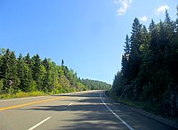
Route 172 (Québec)
| Route 172 in Quebec, Canada | |||||||||||||||||||||||||||||||||||||||||||

|
|||||||||||||||||||||||||||||||||||||||||||
| map | |||||||||||||||||||||||||||||||||||||||||||
| Basic data | |||||||||||||||||||||||||||||||||||||||||||
| Operator: | Ministère des Transports du Québec | ||||||||||||||||||||||||||||||||||||||||||
| Start of the street: | 6 km north of Tadoussac (junction from ( 48 ° 11 ′ N , 69 ° 42 ′ W ) |
||||||||||||||||||||||||||||||||||||||||||
| End of street: | 5.5 km west of Saint-Nazaire (branch of ( 48 ° 36 ′ N , 71 ° 37 ′ W ) |
||||||||||||||||||||||||||||||||||||||||||
| Overall length: | 169.1 km | ||||||||||||||||||||||||||||||||||||||||||
|
Region : |
|||||||||||||||||||||||||||||||||||||||||||
|
Course of the road
|
|||||||||||||||||||||||||||||||||||||||||||
The Route 172 is a state highway ( Route nationale ) of the Canadian province of Quebec and performs the administrative regions of Côte-Nord and Saguenay-Lac-Saint-Jean .
Route description
The 169.1 km long national road connects Route 138 north of Tadoussac with Saguenay and ends north of Alma on Route 169 . The trunk road runs in a predominantly westerly direction parallel to the north bank of the Saguenay Fjord and then north of the river of the Rivière Saguenay . The eastern section of the road is also called Route de Tadoussac .

