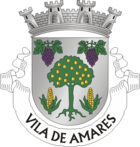
Amares
| Amares | ||||||
|---|---|---|---|---|---|---|
|
||||||
| Basic data | ||||||
| Region : | Norte | |||||
| Sub-region : | Cávado | |||||
| District : | Braga | |||||
| Concelho : | Amares | |||||
| Coordinates : | 41 ° 38 ′ N , 8 ° 21 ′ W | |||||
| Residents: | 1551 (as of June 30, 2011) | |||||
| Surface: | 1.37 km² (as of January 1, 2010) | |||||
| Population density : | 1132 inhabitants per km² | |||||
| Amares county | ||||||
|
||||||
| Residents: | 18,889 (as of June 30, 2011) | |||||
| Surface: | 81.96 km² (as of January 1, 2010) | |||||
| Population density : | 230 inhabitants per km² | |||||
| Number of municipalities : | 16 | |||||
| administration | ||||||
| Administration address: | Câmara Municipal de Amares Largo do Município 4720-058 Amares |
|||||
| President of the Câmara Municipal: | José Lopes Gonçalves Barbosa (AP) | |||||
| Website: | www.cm-amares.pt | |||||
Amares is a small town ( Vila ) and a district ( Concelho ) in Portugal with 1551 inhabitants (as of June 30, 2011).
history
The place was founded at the time of the Roman occupation, and probably goes back to a hill fort ( Portuguese : Castro ) of the Lusitanians . The first official mention comes from a document from 960.
Amares got its town charter ( Foral ) in the year 1514 by King Manuel I .
Culture and sights
Most of the district's attractions are in the municipalities outside the county seat, including the Bouro monastery in Santa Maria do Bouro , or the thermal baths in Caldelas . In the pilgrimage church Santuário de Nossa Senhora da Abadia , also in Santa Maria do Bouro, there is also a museum, in which mainly sacred art is shown.
In Amares itself, some sacred buildings and former public buildings are listed, and the historical center of the place as a whole is protected.
administration
circle
Amares is the seat of a district of the same name. The neighboring areas are (starting clockwise in the north): Terras de Bouro , Vieira do Minho , Póvoa de Lanhoso , Braga and Vila Verde .
With the regional reform in September 2013, several municipalities were merged into new municipalities, so that the number of municipalities decreased from 24 to 16. The following municipalities ( Freguesias ) are in the Amares district:
| local community | Population (2011) |
Area km² |
Density of population / km² |
LAU code |
|---|---|---|---|---|
| Amares e Figueiredo | 2,654 | 4.56 | 582 | 030125 |
| Barreiros | 760 | 2.99 | 254 | 030102 |
| Bico | 777 | 2.29 | 339 | 030104 |
| Caires | 868 | 4.72 | 184 | 030105 |
| Caldelas, Sequeiros e Paranhos | 1,187 | 11.37 | 104 | 030126 |
| Ferreiros, Prozelo e Besteiros | 4,573 | 7.34 | 623 | 030127 |
| Carrazedo | 732 | 2.71 | 270 | 030107 |
| Dornelas | 508 | 3.39 | 150 | 030108 |
| Fiscal | 718 | 3.90 | 184 | 030111 |
| Goães | 557 | 3.03 | 184 | 030112 |
| Lago | 1.910 | 3.99 | 479 | 030113 |
| Return calls | 1,124 | 3.06 | 367 | 030118 |
| Santa Maria do Bouro | 760 | 6.92 | 110 | 030119 |
| Santa Marta do Bouro | 490 | 9.50 | 52 | 030120 |
| Torre e Portela | 626 | 3.59 | 174 | 030128 |
| Vilela, Seramil e Paredes Secas | 645 | 8.60 | 75 | 030129 |
| Amares county | 18,889 | 81.96 | 230 | 0301 |
Population development
| Amares County population (1801–2011) | |||||||||
|---|---|---|---|---|---|---|---|---|---|
| 1801 | 1849 | 1900 | 1930 | 1960 | 1981 | 1991 | 2001 | 2011 | |
| 5,411 | 8,030 | 12,746 | 13,878 | 16,845 | 16,478 | 16,715 | 18,521 | 18,889 | |
Town twinning
-
 France : Saint-Paul-lès-Dax , Arrondissement Dax (since 1993)
Sons and daughters
- Gualdim Pais (1118–1195), crusader, founder of the city of Tomar
- António Variações (1944–1984), pop musician
- Vergílio Alberto Vieira (* 1950), poet, writer and literary critic
- Manuel Araújo (* 1952), journalist
- Marco André Azevedo Gonçalves (* 1978), football player
In 1558 the poet Francisco de Sá de Miranda died here.
Web links
- Map of the Freguesia Amares at the Instituto Geográfico do Exército
- Official website
Individual evidence
- ↑ www.ine.pt - indicator resident population by place of residence and sex; Decennial in the database of the Instituto Nacional de Estatística
- ↑ a b Overview of code assignments from Freguesias on epp.eurostat.ec.europa.eu
- ↑ www.ine.pt - indicator resident population by place of residence and sex; Decennial in the database of the Instituto Nacional de Estatística
- ↑ www.verportugal.net , accessed January 30, 2013
- ↑ www.monumentos.pt , accessed on January 30, 2013
- ^ Publication of the administrative reorganization in the Diário da República gazette of January 28, 2013, accessed on March 16, 2014
- ↑ www.anmp.pt , accessed January 30, 2013


