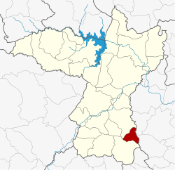
Amphoe Pueai Noi
|
Pueai Noi เปือยน้อย |
|
|---|---|
| Province: | Khon Kaen |
| Surface: | 173.0 km² |
| Residents: | 19,981 (2013) |
| Population density : | 114.1 U / km² |
| ZIP : | 40340 |
| Geocode : | 4011 |
| map | |

|
|
Amphoe Pueai Noi ( Thai : อำเภอ เปือยน้อย ) is a district ( amphoe - administrative district) in the province of Khon Kaen . The province of Khon Kaen is located in the northeast region of Thailand , the so-called Isan .
geography
Neighboring districts are (from the south clockwise) Amphoe Nong Song Hong and Ban Phai in the province of Khon Kaen and Amphoe Kut rank and Na Chueak the province of Maha Sarakham .
history
Phueai Noi was initially set up as a “branch circle” ( King Amphoe ) on January 17, 1977 , by separating the two tambon Phueai Noi and Wang Muang from the Ban Phai district . On July 4, 1994, it was promoted to Amphoe.
Attractions
- Prasat Pueay Noi (Thai: ปราสาท เปือยน้อย ) - well-preserved complex from the Khmer period, is located about 78 kilometers south of the provincial capital Khon Kaen: three brick buildings on a common laterite foundation with differently designed lintels made of sandstone. The ensemble is surrounded by a moat.
Administrative units
Provincial Administration
The district of Pueai Noi is divided into four tambon ("subdistricts" or "municipalities"), which are further subdivided into 32 muban ("villages").
| No. | Surname | Thai | Muban | Pop. |
|---|---|---|---|---|
| 1. | Pueai Noi | เปือยน้อย | 7th | 4,422 |
| 2. | Wang Muang | วัง ม่วง | 8th | 6,391 |
| 3. | Kham Pom | ขาม ป้อม | 10 | 5,519 |
| 4th | Sa Kaeo | สระแก้ว | 7th | 3,649 |
Local administration
There are two municipalities with "small town" status ( Thesaban Tambon ) in the district:
- Pueai Noi (Thai: เทศบาล ตำบล เปือยน้อย ), consisting of parts of the tambon Phueai Noi and Sa Kaeo,
- Sa Kaeo (Thai: เทศบาล ตำบล สระแก้ว ), also consisting of parts of the Tambon Phueai Noi and Sa Kaeo.
There are also two " Tambon Administrative Organizations " ( องค์การ บริหาร ส่วน ตำบล - Tambon Administrative Organizations, TAO):
- Wang Muang (Thai: องค์การ บริหาร ส่วน ตำบล วัง ม่วง )
- Kham Pom (Thai: องค์การ บริหาร ส่วน ตำบล ขาม ป้อม )
Individual evidence
- ↑ ประกาศ กระทรวง มหาดไทย เรื่อง แบ่ง ท้องที่ อำเภอ บ้านไผ่ จังหวัด ขอนแก่น ตั้ง เป็น กิ่ง อำเภอ เปือยน้อย . In: Royal Gazette . 94, No. 8 ง , January 25, 1977, p. 306.
- ↑ พระราชกฤษฎีกา ตั้ง อำเภอ เปือยน้อย ... และ อำเภอ ศรีวิไล พ.ศ. ๒๕๓๗ . In: Royal Gazette . 111, No. 21 ก , June 3, 1994, pp. 32-35.
- ↑ Prasat Pueay Noi - information and description of the location in Thai
- ↑ 2013 population statistics ( Thai ) Department of Provincial Administration. Retrieved July 29, 2014.
Web links
Coordinates: 15 ° 52 ' N , 102 ° 54' E
