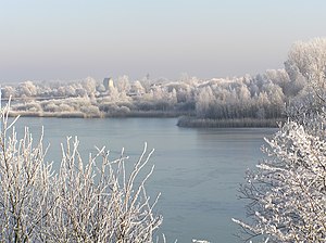
Onshore pond Groß Bülten-Adenstedt (nature reserve)
|
Onshore pond Groß Bülten-Adenstedt
|
||
|
Landing pond in winter |
||
| location | Ilsede , Peine district , Lower Saxony | |
| surface | 50 ha | |
| Identifier | NSG BR 059 | |
| WDPA ID | 162295 | |
| Geographical location | 52 ° 15 ' N , 10 ° 11' E | |
|
|
||
| Sea level | from 75 m to 80 m | |
| Setup date | August 15, 1984 | |
| administration | NLWKN | |
The onshore pond Groß Bülten-Adenstedt is a nature reserve in the Lower Saxony municipality of Ilsede in the Peine district .
The nature reserve with the registration number NSG BR 059 is around 50 hectares in size. In the northwest, it borders the conservation area "Lah". The nature reserve has been under protection since August 15, 1984. The responsible lower nature conservation authority is the district of Peine.
The nature reserve is located southwest of Peine between the Ilseder districts Groß Bülten or Ölsburg and Adenstedt in the Braunschweig-Hildesheimer Lößbörde . It places a still water (→ Auflandeteich Groß Bülten-Adenstedt ) created by sand mining and later used as an ore clarification pond with its bank areas under protection. Due to the earlier use as a collecting and settling basin for pit water , the body of water is heavily silted up and often only of shallow water depth. Fluctuating water levels have led to the formation of extensive, alternating wet mud surfaces in the bank areas. In places, patchy pioneer vegetation settles on the mud flats . In the eastern part of the water in particular, large-scale and species-rich reed stands can be found. Some endangered plant species and communities settle here. Since the bottom sludge is salty , plants adapted to salty locations can also be found , including the salt pond rush . The embankment in the north of the pond drops off steeply so that no muddy surfaces could form here. The bank area is characterized by dry, largely natural ruderal meadows with dry grass flora . Areas made up of wood and surrounding the nature reserve are connected to the bank areas.
The nature reserve is an important refuge for amphibians as well as waders and water birds . Furthermore, the woods surrounding the water and the reed zones offer songbirds , including the Fitis , a suitable habitat.
In the northeast of the onshore pond there is an observation post and tower, from which the area can be viewed. A hill bordering the nature reserve in the northeast allows an overview of the nature reserve. An approximately 300 meter long bank area in the northeast of the water is used by a fishing club for fishing . In the northwest and northeast the nature reserve borders on forest areas. Otherwise it is surrounded by intensively used, agricultural land . The area is also used for local recreation .
Web links
- Nature reserve "Auflandeteich Groß Bülten-Adenstedt (nature reserve)" in the database of the Lower Saxony State Agency for Water Management, Coastal and Nature Conservation (NLWKN)
- Landing pond in Groß Bülten and Adenstedt , Ilsede municipality
Individual evidence
- ↑ Annual report 2014 , Peiner Biologische Arbeitsgemeinschaft 1953 e. V. (PDF file, 7.4 MB). Retrieved February 15, 2017.
- ^ Adenstedt , fishing association Peine-Ilsede and surroundings e. V. Accessed April 11, 2018.


