Bech (Bergisch Gladbach)
|
Bech
City of Bergisch Gladbach
Coordinates: 50 ° 59 ′ 46 ″ N , 7 ° 11 ′ 37 ″ E
|
||
|---|---|---|
|
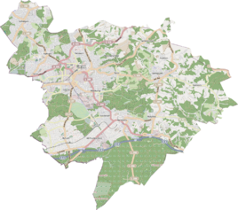
Location of Bech in Bergisch Gladbach |
||
|
House in Bech
|
||
Bech is a district in the Asselborn district of Bergisch Gladbach .
history
Bech is a medieval settlement that has the original cadastre south of the Büchelterhof . There the connecting road from Bech to Herkenrath bears the name Weg von Hohnbach to Büchel and Bech in its historical course . In the Herkenrath church bank regulation of 1630, the court was listed under the name “das guit in der bech” . By 1905 the farm had developed into a small hamlet with seven buildings and 28 residents. The settlement name Bech is derived from the Germanic “bakja” or the Old High German “bah” and the Middle High German “bechel / bechelin” (= small stream). This refers to the Asselborner Bach , which has driven the Asselborn mill further north .
The Topographia Ducatus Montani by Erich Philipp Ploennies , Blatt Amt Porz , proves that the residential area was categorized as a courtyard in 1715 and was named Bech . At that time, Bech belonged to the Herkenrath family .
Under the French administration between 1806 and 1813, the Porz office was dissolved and Bech was politically assigned to Mairie Bensberg in the canton of Bensberg . In 1816 the Prussians converted the Mairie to the mayor's office in Bensberg in the Mülheim am Rhein district .
The place is recorded on the topographical survey of the Rhineland from 1824 without a name and on the Prussian first survey of 1840 as Bech . From the Prussian new admission in 1892, it is regularly recorded on measuring table sheets as Bech or without a name.
Due to the Cologne Act , the city of Bensberg was merged with Bergisch Gladbach to form the city of Bergisch Gladbach with effect from January 1, 1975. Bech also became part of Bergisch Gladbach.
| year | Residents | Residential
building |
category | Political / Church affiliation |
|---|---|---|---|---|
| 1871 | 39 | 6th | Yard | Bensberg mayor, Herkenrath parish |
| 1885 | 28 | 6th | Locality | Bensberg mayor's office, Herkenrath Catholic parish |
| 1895 | 33 | 6th | Locality | Bensberg mayor's office, Herkenrath Catholic parish |
| 1905 | 28 | 7th | Locality | Bensberg mayor's office, Herkenrath Catholic parish |
Mining
About 300 m west of Bech and about 300 m northeast of Breitenweg was the Wilhelminenzeche mine on a slope sloping to the northwest . From her we see here is a Pinge of the air shaft , which one to weathering of the underlying Wilhelminen-tunnel drilled had. It is a registered ground monument .
Individual evidence
- ^ Andree Schulte: Bergisch Gladbach City History in Street Names , published by the Bergisch Gladbach City Archives, Volume 3, and by the Bergisch Geschichtsverein department Rhein-Berg e. V., Volume 11, Bergisch Gladbach 1995, p. 213, ISBN 3-9804448-0-5
- ^ Wilhelm Fabricius : Explanations for the Historical Atlas of the Rhine Province ; Second volume: The map of 1789. Division and development of the territories from 1600 to 1794 ; Bonn; 1898
- ↑ Royal Statistical Bureau Prussia (ed.): The communities and manor districts of the Prussian state and their population . The Rhine Province, No. XI . Berlin 1874.
- ↑ Königliches Statistisches Bureau (Prussia) (Ed.): Community encyclopedia for the Rhineland Province, based on the materials of the census of December 1, 1885 and other official sources, (Community encyclopedia for the Kingdom of Prussia, Volume XII), Berlin 1888.
- ↑ Königliches Statistisches Bureau (Prussia) (Ed.): Community encyclopedia for the Rhineland Province, based on the materials of the census of December 1, 1895 and other official sources, (Community encyclopedia for the Kingdom of Prussia, Volume XII), Berlin 1897.
- ↑ Königliches Statistisches Bureau (Prussia) (Ed.): Community encyclopedia for the Rhineland Province, based on the materials of the census of December 1, 1905 and other official sources, (Community encyclopedia for the Kingdom of Prussia, Issue XII), Berlin 1909.


