Asselborn (Bergisch Gladbach)
|
Asselborn
City of Bergisch Gladbach
Coordinates: 50 ° 59 ′ 56 ″ N , 7 ° 11 ′ 32 ″ E
|
||
|---|---|---|
| Height : | 187 m above sea level NN | |
| Area : | 1.35 km² | |
| Residents : | 906 (December 31, 2017) | |
| Population density : | 671 inhabitants / km² | |
| Postal code : | 51429 | |
| Area code : | 02204 | |
|
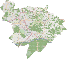
Location of Asselborn in Bergisch Gladbach |
||
|
Gut Asselborn
|
||
Asselborn is a district of Bergisch Gladbach and belongs to the statistics district 4 of the city under No. 42.
history
Asselborn is a medieval settlement name that is recorded for 1294 in the form de Astelburne . The meaning of the name can only be guessed at. The designation probably indicated a source (born = source) in a hazel bush (dialect "Hassel" or "Assel" = hazel). On the other hand, the name could be derived from the Middle High German "astach" (= summit, branches and twigs of felled trees), which would result in a reference to clearing activities. The name Asselborn also bears a medieval manor near today's street, which was first named Giselbert de Astelburne and is recorded in the original cadastre as Asenborns Hof . The Herkenrath order of pews from 1630 names the estate as Asselborner Hoff . Even today, the population of Asselborn perceives the residential area as part of Herkenrath.
According to the survey of the government district of Cöln , the place categorized as “farm goods” had eleven houses in 1845. At that time 74 people lived in the place, all of them Catholic faith.
population
According to the population register, Asselborn was one of the smallest districts of Bergisch Gladbach on June 30, 2017, with a total of 907 inhabitants (including 47 foreigners). The age group under 18 with 163 inhabitants (including 10 foreigners) was almost the same as the age group over 65 with 164 inhabitants (including 0 foreigners).
Mining
Medieval traces of mining can still be found on the former site of the former Washington mine , also popularly known as Silberkaule . Many miners from the area had been employed there since the middle of the 19th century. The Wilhelminenzeche pit was located near the Büchelterhof .
See also
Individual evidence
- ^ City of Bergisch Gladbach, The Mayor, Statistics Service (ed.): Selected population structure data . December 31, 2017, p. 7 ( population data including households [PDF; 82 kB ; accessed on November 15, 2018] A compact overview (as of December 31, 2017) contains the current population structure data according to individual districts (formerly: residential places)).
- ^ A b Andree Schulte: Bergisch Gladbach. City history in street names. Ed. Stadtarchiv, Bergisch Gladbach 1995, p. 212 ff., ISBN 3-9804448-0-5
- ↑ Overview of the components and list of all the localities and individually named properties of the government district of Cologne: by districts, mayor's offices and parishes, with information on the number of people and the residential buildings, as well as the Confessions, Jurisdictions, Military and former state conditions. / ed. from the Royal Government of Cologne [Cologne], [1845]
- ^ Statistics - City of Bergisch Gladbach. Retrieved July 26, 2017 .


