
Brooch Island
| Brooch Island | ||
|---|---|---|
 |
||
| Waters | Arctic Ocean | |
| Archipelago | Franz Josef Land | |
| Geographical location | 81 ° 6 '7 " N , 58 ° 20' 51" E | |
|
||
| length | 500 m | |
| width | 400 m | |
| surface | 12 ha | |
| Highest elevation | 85 m | |
| Residents | uninhabited | |
 |
||

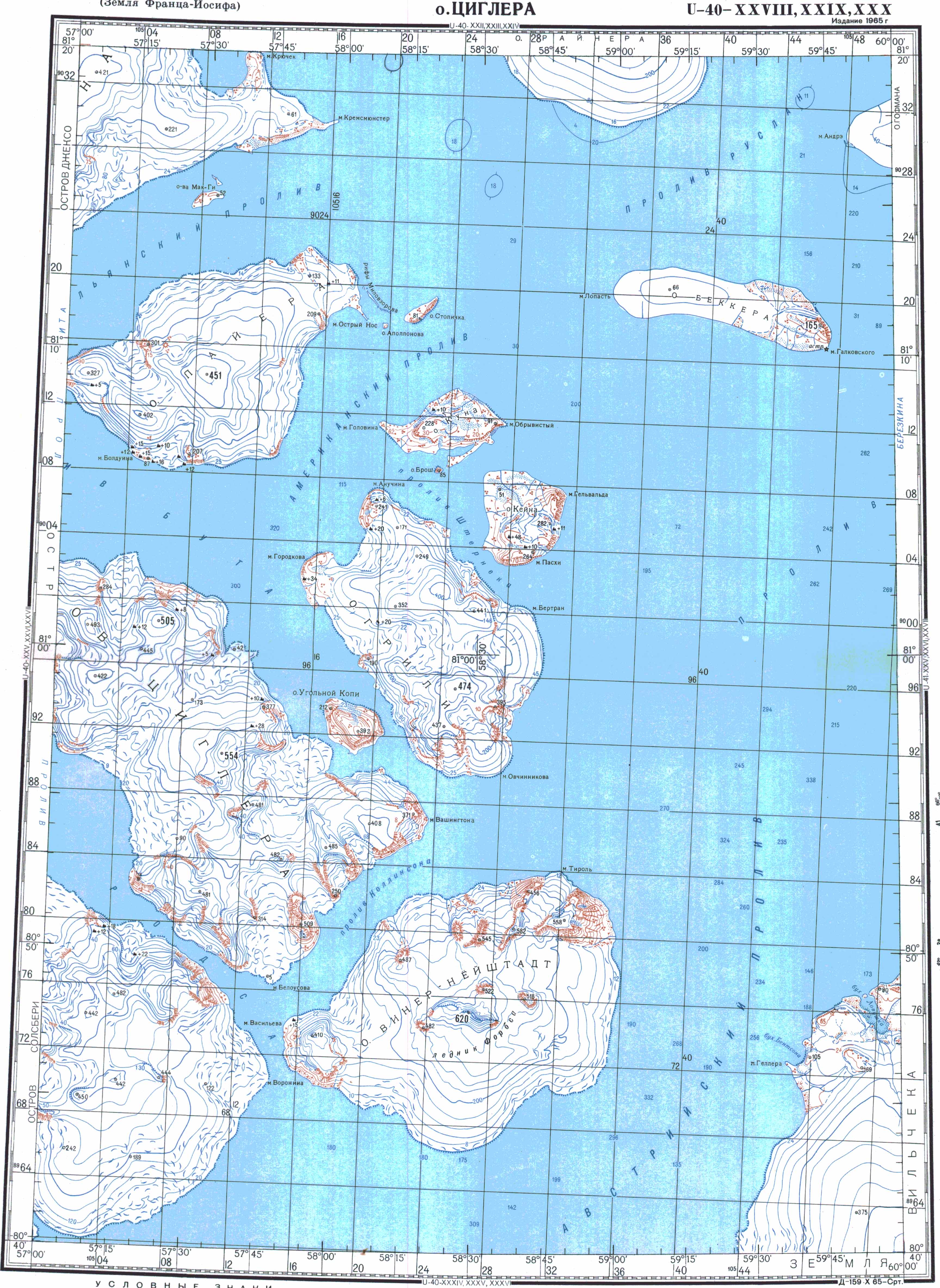
The Brosch Island ( Russian Остров Брош ; Ostrow Brosch) is an island in the Arctic Archipelago Franz Josef Land . Administratively, it belongs to the Russian Arkhangelsk Oblast .
geography
Brooch Island measures almost half a kilometer in diameter. It is 12 hectares in size and rises 85 m above sea level.
The island is located in the east of the central group of Franz Josef Lands (Zichy Islands). It is located south of Kuhn Island , from which it is only about 200 meters away, in Sterneck Sound. Greely Island is to the south and Kane Island to the west .

history
The island appears for the first time on a map of the British polar explorer Frederick Jackson from 1898. It was named after ship lieutenant Gustav Brosch (1844–1924), a participant in the Austro-Hungarian North Pole Expedition from 1872 to 1874. The island is likely a discovery of this expedition, since Jackson did not visit the region around Brosch Island himself. Brooch Island is not shown on the earlier maps by Julius Payers and Fridtjof Nansen .
Individual evidence
- ↑ Topographic map U-40-XXVIII, IXXX, XXX (scale 1: 200,000)
- ^ Julius Payer: The Austro-Hungarian North Pole Expedition in the years 1872–1874 , Alfred Hölder, Vienna 1876. Original map of the Emperor Franz Josef Land
- ↑ Fridtjof Nansen: In night and ice . Second volume, Brockhaus, Leipzig 1897. Preliminary map sketch of the group of islands known as Franz-Joseph-Land
Web links
- Andreas Umbreit: Brosch-Insel on the website www.franz-josef-land.info
Aagaard Island | Adelaide Island | Alexandraland | Alger Island | Apollo Island | Arthur Island | Becker Island | Bell Island | Berghaus Island | Bliss Island | Borisjak Island | Brady Island | Brooch Island | Brice Island | Bromwich Island | Brown Islands | Bruce Island | Champ Island | Coburg Island | David Island | Davis Island | Derevyanny Island | Dicks Island | Eaton Island | Etheridge Islands | Elizabeth Island | Eva Liv Island | Freeden Island | Geddes Island | Gorbunow Island | Graham Bell Island | Greely Island | Hall Island | Harley Island | Hayes Island | Hochstetter Islands | Hoffmann Island | Hohenlohe Island | Hooker Island | Houen Island | Ivanov Island | Jackson Island | Jefferson Island | Kane Island | Karl Alexander Island | Klagenfurt Island | Kling Island | Bud Island | Koettlitz Island | Koldewey Island | Komsomol Islands | Kupolok Island | Kuchin Islands | Kuhn Island | La Ronciere Island | Lamont Island | Leigh Smith Island | Levanewski Island | Luigi Island | Luetke Island | Mabel Island | MacGee Islands | May Island | Maly Island | Marley Island | Mathilda Island | McClintock Island | McNulty Island | Nansen Island | Newcomb Island | Newton Island | Nitsch Island | Northbrook Island | Nowy Island | Ommanney Island | Payer Island | Mother-of-Pearl Island | Pontremoli Islands | Prince Georg Land | Querini island | Rainer Island | Robinson Island | Royal Society Island | Rudolf Island | Salisbury Island | Salm Island | Schönau Island | Scott Keltie Island | Solovyov Island | Stoliczka Island | Sub-island | Tillo Island | Torup Island | Tom Island | Trjochluchewoi Island | Chichagov Islands | Udachny Island | Ugolnoi Kopi Island | Weyprecht Island | Windward Island | Wiener Neustadt Island | Wilczek Island | Wilczek-Land | Ziegler Island