
Luetke Island
| Luetke Island | ||
|---|---|---|
 |
||
| Waters | Arctic Ocean | |
| Archipelago | Franz Josef Land | |
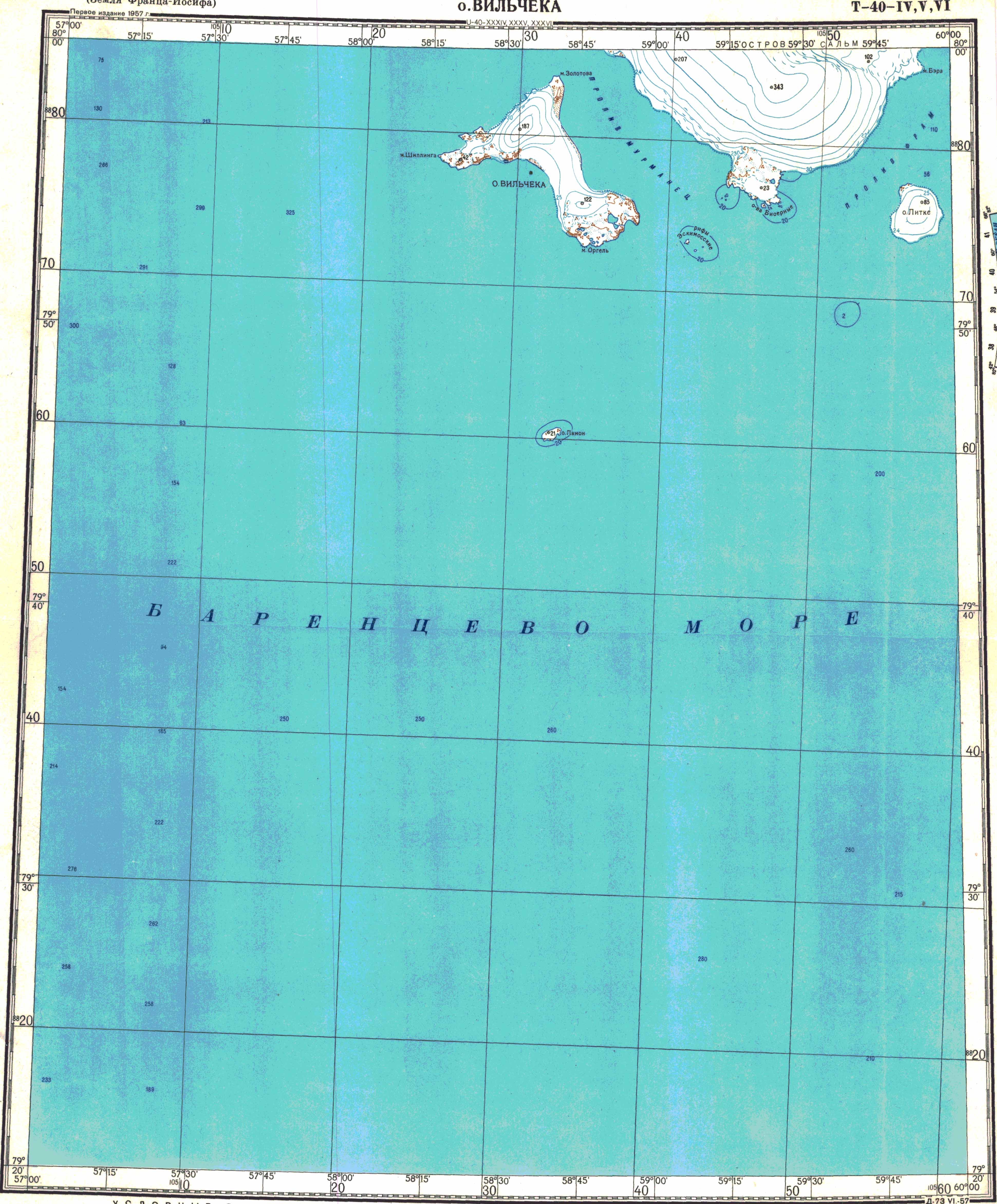
| Geographical location | 79 ° 54 ' N , 59 ° 54' E | |
|
||
| length | 3.6 | |
| width | 2.6 | |
| surface | 8 km² | |
| Highest elevation | 85 m | |
| Residents | uninhabited | |

The Lütke Island ( Russian Остров Литке ; Ostrow Litke) is the southeasternmost island in the arctic Franz Josef Land . Administratively, like the entire archipelago, it belongs to the Russian Arkhangelsk Oblast .
geography
The island is located southeast of Salm Island and is separated from it by the 4.2 km wide Framsund. It is round in shape, 3.6 km long and 2.6 km wide. Their area is around 8 km². The Lütke Island is covered by an 85 m high ice cap that extends almost everywhere to the coast.
history
The Lütke Island is one of the first to be discovered by the Austro-Hungarian North Pole Expedition in 1873 . The expedition ship Admiral Tegetthoff had drifted with the pack ice up to Wilczek Island, 17 km to the east . From here the archipelago was explored by Julius Payer on three sleigh journeys in autumn 1873 and in spring 1874. Payer gave the island its name in memory of Friedrich Benjamin von Lütke , a Baltic German officer in the Russian Navy, who mapped the Novaya Zemlya coast from 1821 to 1824 .
literature
- Julius Payer: The Austro-Hungarian North Pole Expedition in the years 1872–1874, together with a sketch of the second German North Pole expedition 1869–1870 and the polar expedition of 1871 , Alfred Hölder, Vienna 1876.
Web links
- Topographic map U-40-IV, V, VI (scale 1: 200,000)

Aagaard Island | Adelaide Island | Alexandraland | Alger Island | Apollo Island | Arthur Island | Becker Island | Bell Island | Berghaus Island | Bliss Island | Borisjak Island | Brady Island | Brooch Island | Brice Island | Bromwich Island | Brown Islands | Bruce Island | Champ Island | Coburg Island | David Island | Davis Island | Derevyanny Island | Dicks Island | Eaton Island | Etheridge Islands | Elizabeth Island | Eva Liv Island | Freeden Island | Geddes Island | Gorbunow Island | Graham Bell Island | Greely Island | Hall Island | Harley Island | Hayes Island | Hochstetter Islands | Hoffmann Island | Hohenlohe Island | Hooker Island | Houen Island | Ivanov Island | Jackson Island | Jefferson Island | Kane Island | Karl Alexander Island | Klagenfurt Island | Kling Island | Bud Island | Koettlitz Island | Koldewey Island | Komsomol Islands | Kupolok Island | Kuchin Islands | Kuhn Island | La Ronciere Island | Lamont Island | Leigh Smith Island | Levanewski Island | Luigi Island | Luetke Island | Mabel Island | MacGee Islands | May Island | Maly Island | Marley Island | Mathilda Island | McClintock Island | McNulty Island | Nansen Island | Newcomb Island | Newton Island | Nitsch Island | Northbrook Island | Nowy Island | Ommanney Island | Payer Island | Mother-of-Pearl Island | Pontremoli Islands | Prince Georg Land | Querini island | Rainer Island | Robinson Island | Royal Society Island | Rudolf Island | Salisbury Island | Salm Island | Schönau Island | Scott Keltie Island | Solovyov Island | Stoliczka Island | Sub-island | Tillo Island | Torup Island | Tom Island | Trjochluchewoi Island | Chichagov Islands | Udachny Island | Ugolnoi Kopi Island | Weyprecht Island | Windward Island | Wiener Neustadt Island | Wilczek Island | Wilczek-Land | Ziegler Island