Brtníky
| Brtníky | ||||
|---|---|---|---|---|
|
||||
| Basic data | ||||
| State : |
|
|||
| Region : | Ústecký kraj | |||
| District : | Děčín | |||
| Municipality : | Staré Křečany | |||
| Area : | 1045.7075 ha | |||
| Geographic location : | 50 ° 57 ' N , 14 ° 26' E | |||
| Height: | 406 m nm | |||
| Residents : | 257 (March 1, 2001) | |||
| Postal code : | 407 60 | |||
| License plate : | U | |||
| traffic | ||||
| Street: | Mikulášovice - Krásná Lípa | |||
| Railway connection: | Rumburk – Mikulášovice | |||
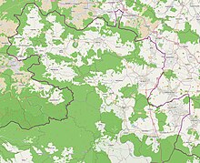
Brtníky , until 1947 Zeidler , is a district of Staré Křečany in the north of the Czech Republic in the Okres Děčín ( Ústecký kraj ). It is located in the Bohemian Netherlands on the North Bohemian Industrial Railway and on the roads from Mikulášovice to Krásná Lípa and Staré Křečany. In the immediate vicinity of the place is the 580 m high Wolfsberg and the source of the Mandau .
history
The history of the municipality goes back to the year 1346 when it was first mentioned. Your name can be derived from the forest beekeeping (Zeidelweide) located here at that time. The most important building in Zeidler was the baroque church of St. Martin . Due to neglect and the subsequent dilapidation, the building, where a vaulted ceiling had already collapsed, had to be blown up and removed in 1975. The nearby cemetery still exists today. Other buildings are today's children's home on the main street, the cross chapel on the 446 m high Křížový vrch (German Kreuzberg ) and some half-timbered or half-timbered houses .
The place is of particular interest to geologists, because it is the border between the sandstone region of Bohemian Switzerland and the Lusatian granite region of the Bohemian Netherlands .
After the abolition of patrimonial Zeidler formed from 1849 with the districts Hemmehübel ( Kopec ) and Sternberg ( Šternberk ) a municipality in the judicial district of Hainspach . From 1868 Zeidler belonged to the Schluckenau district . In 1902 the place was connected to the North Bohemian Industrial Railway. This railway line also has its most important structure in Brtniky , namely the steel girder truss bridge over the connecting road to Staré Křečany . Today, this connection is only operated at 2-hour intervals on weekends.
In 1930 Zeidler had 1,513 inhabitants. In October 1938, as a result of the Munich Agreement , the municipality was added to the German Reich and initially belonged to the Schluckenau district . On May 1, 1939, Zeidler was assigned to the Rumburg district . In the 1939 census, 1,358 people lived in the community of Zeidler. Up until 1945 the place owned some big world-famous companies in the lace and hosiery industry, some of which can still be seen today on the lattice bridge over the road to Staré Křečany . After the end of the Second World War, Zeidler came back to Czechoslovakia and became part of the Okres Rumburk. The German-Bohemian population was driven out of the place, resulting in a large population decline and a large decline in industry. In 1947 the name was changed to Brtníky, the district Hemmehübel was given the new name Kopec . In the course of the territorial reform of 1960, Brtníky was assigned to the Okres Děčín . On July 1, 1980 it was incorporated into Staré Křečany. Today the place is mainly used for agriculture.
In 1991 Brtníky had 272 inhabitants. In 2001 the place consisted of 109 houses in which 257 people lived. In total, Brtníky consists of 223 houses.
Thanks to the reconstruction of the Rumburk-Sebnitz railway line , Brtniky is also of major tourist importance for visitors from the Elbe Valley to Dresden ; The Wolfsberg is 2.5 km away from the stop , the place of the same name is 5 km away. The Sternberg Hunting Lodge is also 5 km away, and the hike to Šluknov over the Zeleny Kriz (German: green cross) is 10 km long . Another 10 km hike to Kyjow with the source of the Kirnitzsch . And for extreme hikers, the route to Sebnitz with 25 km or to Hřensko via the Tokani , the Dittersbach rock area and the Prebischtor with 40 km is recommended as a starting point.
literature
- Peter Rölke (Ed.): Hiking & Nature Guide Bohemian Switzerland, České Švýcarsko. Berg- und Naturverlag Roelke, Dresden 2011, ISBN 3-934514-07-3 .
Individual evidence
- ↑ http://www.uir.cz/katastralni-uzemi/612987/Brtniky
- ↑ Předpis č. 7/1948 Sb.
- ^ Michael Rademacher: German administrative history from the unification of the empire in 1871 to the reunification in 1990. Rumburg district. (Online material for the dissertation, Osnabrück 2006).
- ↑ http://www.czso.cz/csu/2009edicniplan.nsf/t/010028D080/$File/13810901.pdf
- ↑ http://www.uir.cz/adresy-objekty-casti-obce/012980/Cast-obce-Brtniky


