Checacupe District
| Checacupe District | |
|---|---|
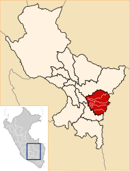
 The district of Checacupe is located in the northwest of the province of Canchis (marked in red) |
|
| Basic data | |
| Country | Peru |
| region | Cusco |
| province | Canchis |
| Seat | Checacupe |
| surface | 937 km² |
| Residents | 5153 (2017) |
| density | 5.5 inhabitants per km² |
| founding | October 14, 1833 |
| ISO 3166-2 | PE-CUS |
| politics | |
| Alcalde District | Temistocles Ccanchi Maldonado (2019-2022) |
| Quelccaya Ice Cap in the far east of the district | |
Coordinates: 14 ° 2 ′ S , 71 ° 27 ′ W
The Checacupe district is located in the Canchis Province of the Cusco region in south-central Peru . The district was founded on October 14, 1833. It has an area of 937 km². At the 2017 census, 5,153 people lived in the district. In 1993 the population was 5037, in 2007 4883. The district administration is located in the 3441 m high small town of Checacupe with 2132 inhabitants (as of 2017). Checacupe is 37 km northwest of the provincial capital Sicuani . The road from Puno to Cusco runs along the Río Vilcanota.
Geographical location
The Checacupe district is located in the Andean highlands in the northwest of Canchis Province. Along the eastern district boundary runs the eastern part of the Cordillera Vilcanota with the Quelccaya ice cap and the 5743 m high Joyllor Puñuna , its highest point. The Río Vilcanota (upper reaches of the Río Urubamba) crosses the far west of the district in a northerly direction. The Río Pitumarca flows into this at Checacupe . The much larger eastern part of the district is drained by the Río Salcca in a southerly direction. There the district in the northeast extends almost to the southern shore of the lake Laguna Sibinacocha .
The district of Checacupe borders in the far west with the districts Mosoc Llacta , Acopía and Sangarará (all three in the province Acomayo ), in the northwest with the district Cusipata ( province Quispicanchi ), in the north with the district Pitumarca , in the northeast with the district Marcapata ( Quispicanchi province), in the east to the Corani district ( Carabaya province ) and in the south to the districts of San Pablo and Combapata .
Localities
In addition to the main town, the district has the following larger towns:
- Chari (288 inhabitants)
- Llocllora (334 inhabitants)
- Occobamba
- Ocuvire
- Palccoyo
- Suttoc
Web links
- Peru: Region Cusco (provinces and districts) at www.citypopulation.de
- INEI Perú
