Christianseck
|
Christianseck
City of Bad Berleburg
Coordinates: 51 ° 3 ′ 27 ″ N , 8 ° 28 ′ 30 ″ E
|
|
|---|---|
| Height : | 510–680 m above sea level NHN |
| Area : | 6.01 km² |
| Residents : | 109 (March 31, 2011) |
| Population density : | 18 inhabitants / km² |
| Postal code : | 57319 |
| Area code : | 02750 |
|
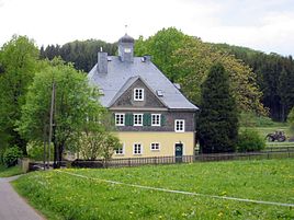
House in Christianseck
|
|
Christianseck is a district of Bad Berleburg in the Siegen-Wittgenstein district in North Rhine-Westphalia. On April 30, 2007 Christianseck had 110 inhabitants. The district belongs to the Ev. Lukas parish in the Eder and Elsofftal valleys.
geography
location
Christianseck is located on a high plateau at an altitude of approx. 620 m above sea level. NHN . 24 houses are spread over 9 km², embedded in a landscape of forest and meadow areas on the Rothaarsteig .
Neighboring places
Settlements
|
|
|
|
history
At the order of Count von Wittgenstein, the first canonists settled in the still completely wooded area from 1708. These settlers are named after the annual interest, the canon . In 1748 the Savoy estate is mentioned. In 1732 Christianseck belongs to the Elsoffer quarter and the Amte Richstein and consists of 7 houses. In 1819 it became a part of the community and the Elsoff district. In 1819 there are 13 houses and 104 inhabitants in Christianseck.
Together with Elsoff, Christianseck was incorporated into the city of Bad Berleburg on January 1, 1975.
Individual evidence
- ^ Federal Statistical Office (ed.): Historical municipality directory for the Federal Republic of Germany. Name, border and key number changes in municipalities, counties and administrative districts from May 27, 1970 to December 31, 1982 . W. Kohlhammer, Stuttgart / Mainz 1983, ISBN 3-17-003263-1 , p. 337 .

