Dakota Dunes
| Dakota Dunes | ||
|---|---|---|
|
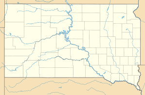
Location in South Dakota
|
||
| Basic data | ||
| Foundation : | 1988 | |
| State : | United States | |
| State : | South Dakota | |
| County : | Union County | |
| Coordinates : | 42 ° 29 ′ N , 96 ° 29 ′ W | |
| Time zone : | Central ( UTC − 6 / −5 ) | |
| Residents : | 2,540 (as of 2010) | |
| Population density : | 313.6 inhabitants per km 2 | |
| Area : | 8.1 km 2 (approx. 3 mi 2 ) | |
| Height : | 333 m | |
| Postal code : | 57049 | |
| Area code : | +1 605 | |
| FIPS : | 46-15250 | |
| GNIS ID : | 1829118 | |
| Website : | www.dakotadunes.com | |
Dakota Dunes is a settlement on community-free area in Union County in the US -amerikanischen State South Dakota . For statistical purposes, the place has been combined to form a census-designated place (CDP) . In 2010 Dakota Dunes had 2540 residents.
geography
Dakota Dunes is the southernmost and lowest-lying town of South Dakota. Dakota Dunes is located at the confluence of the Big Sioux River with the Missouri , which also forms the interface between the states of South Dakota, Iowa and Nebraska .
The geographical coordinates of Dakota Dunes are 42 ° 29'15 "north latitude and 96 ° 29'11" west longitude. The place extends over an area of 8.1 km² and forms the center of the Big Sioux Township .
Neighboring places of Dakota Dunes, besides the lie on the opposite side of the Big Sioux River in Iowa City Sioux nor North Sioux City (7.2 km to the north) and Jefferson (16,3 km northwest) and South Sioux City (14.9 kilometers east-southeast).
The nearest major cities are Sioux Falls (135 km north), Fargo , North Dakota (518 km in the same direction), Minneapolis , Minnesota (455 km northeast), Rochester , Minnesota (450 km east-northeast), Iowa's capital city, Des Moines (329 km km southeast), Omaha , Nebraska (171 km southeast), and Kansas City , Missouri (458 km in the same direction).
traffic
Interstate 29 runs through Dakota Dunes and runs from Kansas City to Winnipeg in the Canadian province of Manitoba . All other roads within Dakota Dunes are suburban interconnecting roads.
By Graham Field is located 8.6 kilometers north a small airfield. The nearest major airports are the Sioux Gateway Airport in Sioux City (23.5 km southeast) and the Sioux Falls Regional Airport , located 139 km to the north , the largest airport in South Dakota.
history
Dakota Dunes is a scheduled settlement for affluent residents. In 1988, MidAmerican Energy Holdings Company , a subsidiary of Berkshire Hathaway , started construction.
Demographic data
According to the 2010 census, the Dakota Dunes had 2,540 people in 969 households. The population density was 313.6 inhabitants per square kilometer. Statistically, there were 2.62 people in each of the 969 households.
The racial the population was composed of 92.0 percent white, 1.6 percent African American, 0.4 percent Native American, 3.4 percent Asian and 0.3 percent from other ethnic groups; 2.3 percent were descended from two or more races. Hispanic or Latino of any race was 2.0 percent of the population.
28.9 percent of the population were under 18 years old, 59.6 percent were between 18 and 64 and 11.5 percent were 65 years or older. 49.5 percent of the population was female.
The average annual income for a household was 110,212 USD . The per capita income was $ 53,372. 0.7 percent of the population lived below the poverty line.
Individual evidence
- ↑ a b American Fact Finder. Retrieved July 4, 2013
- ↑ Distance information according to Google Maps. Accessed July 4, 2013
- ^ History of Dakota Dunes ( February 2, 2014 memento in the Internet Archive ). Retrieved July 4, 2013
