Coayllo district
| Coayllo district | |||
|---|---|---|---|
 The district of Coayllo is located in the northeast of the province of Cañete (marked in red) |
|||
| Symbols | |||
|
|||
| Basic data | |||
| Country | Peru | ||
| region | Lima | ||
| province | Cañete | ||
| Seat | Coayllo | ||
| surface | 600 km² | ||
| Residents | 1095 (2017) | ||
| density | 1.8 inhabitants per km² | ||
| founding | 4th August 1821 | ||
| ISO 3166-2 | PE-LIM | ||
| politics | |||
| Alcalde District | Alexander Chuquizuta Huapaya (2019-2022) |
||
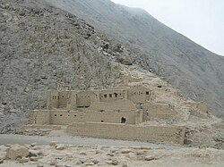
| Uquira archaeological site | |||
Coordinates: 12 ° 44 ′ S , 76 ° 28 ′ W
The Coayllo district is located in the Cañete Province in the Lima region in southwestern Peru . The district was founded on August 4, 1821. It has an area of about 600 km². The 2017 census counted 1095 inhabitants. In 1993 the population was 1020, in 2007 it was 1031. The district administration is located in the 225 m high village of Coayllo with 561 inhabitants (as of 2017). Coayllo is 40 km north of the provincial capital San Vicente de Cañete . The archaeological site of Uquira is located 3.3 km east-northeast of Coayllo not far from the south bank of the Río Omas .
Geographical location
The district of Coayllo is located in the northeast of the province of Cañete. The district lies on the western flank of the Peruvian Western Cordillera . The Río Omas crosses the district in a south-westerly direction. The district is just under 8 km from the sea. Irrigated agriculture is practiced in the river valley of the Río Omas.
The district of Coayllo borders in the southwest with the district Asia , in the west with the district Mala , in the north with the district Calango , in the northeast with the district Omas , in the east with the district Tauripampa (the two aforementioned districts are in the province of Yauyos ) and in the southeast to the Quilmaná district .
Web links
- Peru: Region Lima (provinces and districts) at www.citypopulation.de


