Santa Lucía District (Lampa)
| Santa Lucía district | |||
|---|---|---|---|
| Symbols | |||
|
|||
| Basic data | |||
| Country | Peru | ||
| region | Puno | ||
| province | Lampa | ||
| Seat | Santa Lucía | ||
| surface | 1589 km² | ||
| Residents | 7456 (2017) | ||
| density | 4.7 inhabitants per km² | ||
| founding | April 17, 1936 | ||
| ISO 3166-2 | PE-PUN | ||
| politics | |||
| Alcalde District | Ángel Castillo Colque (2019-2022) |
||
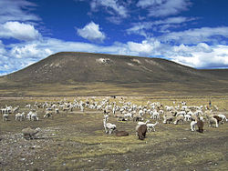
| Alpaca herd | |||
Coordinates: 15 ° 42 ′ S , 70 ° 36 ′ W
The Santa Lucía district is located in the Lampa province of the Puno region in southeastern Peru . The district founded in 1936 has an area of 1589 km². At the 2017 census there were 7,456 residents in the district. In 1993 the population was 7389, in 2007 7692. In 2017 , the main town and administrative seat of Santa Lucía , which is 4090 m high, lived 5278 people.
Geographical location
The district is located in the south of the Lampa province, about 50 km west-southwest of the city of Juliaca . It extends over the Andean highlands west of Lake Titicaca . The area is drained by the River Coata (also Río Cabanillas ) to Lake Titicaca. In the district are the lakes Laguna Lagunillas and Laguna Ananta . The mountains reach heights of over 5200 m . The district borders the regions of Cusco and Arequipa to the west . In the south lies the province of San Román , in the east the district Cabanilla , in the north the districts Paratia and Ocuviri .
Web links
- Peru: Region Puno (provinces and districts) at www.citypopulation.de
- INEI Perú


