
Dosso (region)
| Dosso | |
|---|---|
  |
|
| Basic data | |
| Country | Niger |
| Capital | Dosso |
| surface | 33,844 km² |
| Residents | 2,037,713 (2012) |
| density | 60 inhabitants per km² |
| ISO 3166-2 | NE-3 |
| politics | |
| governor | Ousmane Moussa |
Coordinates: 13 ° 2 ′ N , 3 ° 12 ′ E
The Dosso [ dɔˈso ] region is one of the seven regions of Niger and is located in the south-west of the country. Their capital is Dosso . The region has 2,037,713 inhabitants (2012).
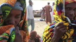
geography
.jpg)
Due to its southern location, Dosso is comparatively rainy and fertile. The Niger River forms the state border here. Dosso borders in the north on the Nigerian region of Tillabéri , in the northeast on the Nigerian region Tahoua , in the southeast on the Nigerian states of Kebbi and Sokoto and in the southwest on the Beninese department of Alibori . In geological terms, the region can be assigned to the Tertiary Age .
The Dosso region is divided into the eight departments of Boboye , Dioundiou , Dogondoutchi , Dosso , Falmey , Gaya , Loga and Tibiri .
history
The Dosso region dates back to the French colonial era. In July 1922, Niger has been in nine circles (cercles) divided consisting of divisions (subdivisions) passed. The Dosso district was made up of the Dosso and Dogondoutchi subdivisions. After Niger gained independence in 1960, the district was replaced on January 1, 1961 by 31 districts (circonscriptions) .
The immediate predecessor of the Dosso region was the Dosso department, which was created by an administrative reform that came into force on October 1, 1965, dividing Niger into seven departments (départements) . The former departments were finally converted into regions (régions) on September 14, 1998 , which in turn are subdivided into departments.
politics

The region is headed by a governor appointed by the Nigerian Council of Ministers . He represents the entire state.
The regional council (conseil régional) of Dosso is an organ of deliberation . It is composed of elected members and members by law . The latter, who are not allowed to occupy more than a fifth of the seats awarded by election, are representatives of the chefferie traditionnelle , the traditional rulers. These include, for example, the Sultan of Dosso. The Dosso Regional Council has 41 elected members.
The President of the Regional Council (président du conseil) and his one or two deputies are an executive body in the region.
population
The area of the Dosso region had around 450,000 inhabitants in 1960, the year Niger became independent. The 1977 census showed 693,207 inhabitants, the 1988 census 1,016,469 and the 2001 census 1,505,864. The 2012 census showed 2,037,713 inhabitants.
The two largest ethnic groups in the region are the Zarma and Songhai with 48% and the Hausa with 42% of the total population. Other ethnic groups in Dosso are the Fulbe with 9% and the Tuareg with 1%.
Economy and Infrastructure
There are 549 primary schools in the Dosso region, three of which are private schools . The gross enrollment rate in the 2009/2010 school year was 73% (nationwide 72.9%), for girls 61.2% (nationwide 63.9%). There was an average of 37 pupils for every primary school teacher (39 nationwide). The primary school graduation rate was 52.1% (nationwide 49.3%), among girls 41.4% (nationwide 41.5%).
literature
- Alain Beauvilain: Eleveurs et élevage le long du fleuve Niger dans le département de Dosso (Niger) . In: Les Cahiers d'Outre-Mer . No. 125 , 1979, pp. 66-102 ( persee.fr ).
- Sabine Dorlöchter-Sulser: Change of livelihood systems in the field of tension between structure and action. A historically based livelihood analysis from 1960 to 2010 using the example of the Dosso region, Niger . wvb, Berlin 2014, ISBN 978-3-86573-787-8 .
Web links
Individual evidence
- ↑ Communiqué du Conseil des Ministres du vendredi 29 June 2016. In: Tamtam Info. July 31, 2016, accessed August 6, 2016 (French).
- ↑ Thomas Krings: Sahel countries . WBG, Darmstadt 2006, ISBN 3-534-11860-X , p. 16.
- ↑ Abdourahmane Idrissa, Samuel Decalo: Historical Dictionary of Niger . 4th edition. Scarecrow, Plymouth 2012, ISBN 0-7864-0495-7 , pp. 30-31 .
- ↑ Loi N ° 2008-42 du 31 July 2008 relative à l'organization et l'administration du territoire de la République du Niger . In: Code général des collectivités territoriales. Recueil des textes sur la decentralization. Edition 2011 . Direction Générale de la Décentralisation et de la Déconcentration, Ministère de l'Intérieur, de la Sécurité, de la Décentralisation et des Affaires Religieuses, République du Niger, Niamey 2010, p. 13 ( decentralization-niger.org [PDF; accessed on September 22, 2019]).
- ^ A b Ordonnance N ° 2010-54 on September 17th, 2010 portant Code Général des Collectivités Territoriales de la République du Niger . In: Code général des collectivités territoriales. Recueil des textes sur la decentralization. Edition 2011 . Direction Générale de la Décentralisation et de la Déconcentration, Ministère de l'Intérieur, de la Sécurité, de la Décentralisation et des Affaires Religieuses, République du Niger, Niamey 2010, p. 53 ( decentralization-niger.org [PDF; accessed on September 22, 2019]).
- ↑ Décret N ° 2010-678 / PCSRD / MISD / AR of 07 octobre 2010 fixant le nombre de sièges par Conseil Régional . In: Code général des collectivités territoriales. Recueil des textes sur la decentralization. Edition 2011 . Direction Générale de la Décentralisation et de la Déconcentration, Ministère de l'Intérieur, de la Sécurité, de la Décentralisation et des Affaires Religieuses, République du Niger, Niamey 2010, p. 182 ( decentralization-niger.org [PDF; accessed September 22, 2019]).
- ^ Institut Nationale de la Statistique du Niger (ed.): Annuaire statistique des cinquante ans d'indépendance du Niger . (PDF; 3.1 MB) Niamey 2010, p. 49.
- ↑ Presentation of the result globaux définitifs du Quatrième (4ème) Recensement Général de la Population et de l'Habitat (RGP / H) de 2012. (PDF) Institut National de la Statistique, 2014, accessed on April 18, 2014 (French).
- ^ Website of the Institut National de la Statistique du Niger ( Memento of February 1, 2012 in the Internet Archive ), accessed on December 27, 2009.
- ↑ Statistiques de l'éducation de base. Annuaire 2009-2010 . (PDF; 19.1 MB) Website of the Nigerien Ministry of Education, September 2010; Retrieved February 14, 2012.