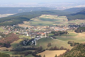
Dreistetten
|
Dreistetten ( village ) locality cadastral community Dreistetten |
||
|---|---|---|
|
|
||
| Basic data | ||
| Pole. District , state | Wiener Neustadt-Land (WB), Lower Austria | |
| Judicial district | Wiener Neustadt | |
| Pole. local community | Piesting market | |
| Coordinates | 47 ° 51 ′ 19 ″ N , 16 ° 6 ′ 19 ″ E | |
| height | 528 m above sea level A. | |
| Residents of the village | 734 (January 1, 2020) | |
| Building status | 290 (2001) | |
| Area d. KG | 10.36 km² | |
| Postcodes | 2721 2753 |
|
| Statistical identification | ||
| Locality code | 06567 | |
| Cadastral parish number | 23404 | |
| Counting district / district | Dreistetten (32 319 001) | |
 Dreistetten seen from the Herrgottschnitzerhaus |
||
| Source: STAT : index of places ; BEV : GEONAM ; NÖGIS | ||
Dreistetten is a former municipality in the south of Lower Austria . In 1975 the village was incorporated into Markt Piesting . About 3/4 kilometers north of the village are the Starhemberg castle ruins , one of the largest castles in Lower Austria.
The Gassengruppenort at an altitude of 528 m emerged from a church hamlet and in 2001 had 571 inhabitants. It is located south of Markt Piesting on a basin between the Hohe Wand and the Fischau foothills , which is also the north-eastern end of the valley of the “New World” basin.
Dreistetten is also a cadastral community , which has an area of 10.35 km² and to which the hamlet of Baumgarten in the north belongs.
history
Dreistetten belonged to the Starhemberg rule. In the Middle Ages, the Starhemberg rulership was part of the Styrian margraves - the Piesting River was the border between Ostmark and Styria . Dreistetten was first mentioned in a document in 1149 . In 1192, Starhemberg Castle and thus the area around Dreistetten came to the Babenbergs through an inheritance contract . In the course of the second Turkish siege of Vienna in 1683 , all 32 houses and the church of Dreistetten were burned down, "the house people are missing for 18 fire ruins".
Attractions
- Starhemberg castle ruins ; an extensive formerly important castle complex on the "mons Starhenberch" north of Dreistetten. First a Styrian complex, in 1192 the handover of Styria and with it the castle to the Babenbergs took place. A Palatinate expansion took place under Frederick the Warriors . After his death in 1246, it was briefly administered by the Teutonic Order . In 1278 after the Battle of Dürnkrut , the fortress passed into Habsburg ownership. In 1482 the castle was taken by the Hungarian King Matthias Corvinus . After several decompositions , the castle was sold to the Counts of Heussenstein in 1590, who owned it for over 200 years and withstood the attack of the Turks in 1683 . It has been owned by the Salvator Habsburg-Lothringen family since 1913.
- Dreistetten parish church : It is located in an elevated position on the western edge of the village and is surrounded by a walled cemetery. The simple nave with a gable roof has baroque arched windows, a wooden beam ceiling and a wooden organ gallery. The main choir square hall is Gothic and dates from the first third of the 14th century. The presented baroque west tower is square and was rebuilt in 1860.
- Unicorn cave ; a small stalactite cave west of Dreistetten at the foot of the high wall. The cave was discovered by Otto Langer in 1927 and opened as a show cave in 1930
- Gasthof Scherrerwirt at the northern exit of the village. A country inn from the end of the 19th century with a rich private folklore collection (private local museum)
- Trinity Column; a sculpture from the second half of the 17th century in the center of Dreistetten
- Herrgottschnitzerhaus, a refuge on the Hohe Wand
Web links
Individual evidence
- ↑ Statistics Austria : Dissolution or associations of municipalities from 1945 ( page no longer available , search in web archives ) Info: The link was automatically marked as defective. Please check the link according to the instructions and then remove this notice. ; Retrieved December 14, 2012
- ↑ Statistics Austria: Census of May 15, 2001 (PDF; 8 kB)
- ↑ Statistics Austria: Local directory 2001: Lower Austria ( Memento of the original from August 14, 2009 in the Internet Archive ) Info: The archive link has been inserted automatically and has not yet been checked. Please check the original and archive link according to the instructions and then remove this notice.
- ↑ Municipality of Markt Piesting: Foundation of Markt Piesting ( Memento of the original from October 11, 2007 in the Internet Archive ) Info: The archive link was automatically inserted and not yet checked. Please check the original and archive link according to the instructions and then remove this notice.
- ↑ Municipality of Markt Piesting: Middle Ages and Turkish Wars ( Memento of the original from October 27, 2007 in the Internet Archive ) Info: The archive link has been inserted automatically and has not yet been checked. Please check the original and archive link according to the instructions and then remove this notice.
- ↑ a b Bundesdenkmalamt (Ed.): Dehio-Handbuch. The art monuments of Austria. Lower Austria, south of the Danube , part 1. Verlag Berger, Horn / Vienna 2003, page 353f, ISBN 3-85028-364-X
- ↑ Einhornhöhle on Zitherwirt.at
- ^ Alpine Association: Herrgottschnitzerhaus

