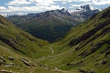
Ice hut
| Ice hut | ||
|---|---|---|
| location | upper Timmeltal ; Tyrol , Austria ; Valley location: Prägraten | |
| Mountain range | Venediger group | |
| Geographical location: | 47 ° 3 '19 " N , 12 ° 22' 44" E | |
| Altitude | 2521 m above sea level A. | |
|
|
||
| owner | Markus Islitzer | |
| Built | 1980 | |
| Construction type | hut | |
| Development | Material ropeway | |
| Usual opening times | Mid June to early October | |
| accommodation | 14 beds, 31 camps | |
| Hut directory | ÖAV DAV | |


The Eisseehütte is a private refuge in the Venediger group .
It is located in the upper Timmeltal in the East Tyrolean community of Prägraten at an altitude of 2521 m above sea level. A. just outside the Hohe Tauern National Park . Just under an hour north of the hut, behind a wall, lies the ice lake at 2664 m above sea level. A.
The hut was built in 1980 and offers a total of 45 beds. It is the starting point for 10 three-thousand-meter peaks.
ways
Approach
The approach is from Prägraten through the Timmeltal in around 3½ hours.
Tours from the Eisseehütte / summit climbs
- Weißspitze , 3300 m , walking time: 4 hours
- Tulpspitze , 3054 m , walking time: 3 hours
- Kreuzspitze , 3164 m
- Schernerskogel , 3043 m , walking time: 4½ hours
- Großer Hexenkopf , 3313 m , walking time: 4½ hours
- Kleiner Hexenkopf, 3194 m , walking time: 4 hours
- Vorderer Seekopf , 3280 m , walking time: 4 hours
- Hinterer Seekopf , 3234 m , walking time: 4 hours
- Wallhorner Törl (Venedigerblick), 3045 m , walking time: 2½ hours
Transitions to other huts
- Badener Hut , 2608 m , walking time: 7 hours
- Bonn-Matreier Hütte , 2750 m , walking time: 3 hours
- Johannishütte , 2121 m , walking time: 3 hours
- Defreggerhaus , 2962 m , walking time: 2½ hours
- Sajathütte , 2600 m , walking time: 3¾ hours
- Nilljochhütte , 1990 m , walking time: 4½ hours
Eagle Walk
- Stage 1: Ascent from Ströden to the Johannishütte 6.5 hours
- Stage 2: Eisseehütte 5 hours
The 2nd stage leads from the Johannishütte via the Sajathütte on a route length of 11 km and 1250 m ascent in 5 hours to the Eisseehütte .
- Stage 3: Bonn-Matreier Hut 3.5 hours
The Eagle Walk leads over the Hohen Eichham in 3.5 hours with a length of 7 km and 600 m ascent to the Badener Hut .
- Stage 4: Badener Hut 5.0 hours
- Stage 5: Matreier Tauernhaus 5.5 hours
- Stage 6: Sudeten German Hut 4.0 hours
- Stage 7: Kalser Tauernhaus 4.0 hours
- Stage 8: Stüdlhütte 6.5 hours
- Stage 9: Lucknerhaus 5.5 hours
Winter tours
In winter, the following ski tours are available from the Eisseehütte:
- small witch's head 3194 m
- front Seekopf 3280 m
- rear Seekopf 3234 m
- Weißsspitze 3300 m,
cards
- Alpine Club Map 36 Venediger Group (1: 25,000)
literature
- Hubert Peterka / Willi End : Alpine Club Leader Venediger Group , Bergverlag Rudolf Rother , Munich 1982. ISBN 3-7633-1242-0
Web links
- Official website of the Eisseehütte. In: www.eisseehuette.at. 2013, accessed March 20, 2013 .
- Ice hut. In: www.hinterbichl.at. March 2, 2009, accessed March 12, 2010 .
- ↑ Adlerweg stage O2: Johannishütte - Eisseehütte. Retrieved June 16, 2019 .
- ↑ Adlerweg stage O3: Eisseehütte - Bonn-Matreier-Hütte. Retrieved June 16, 2019 .
- ↑ A warm welcome - Eisseehütte. Retrieved June 16, 2019 .
- ↑ Alpine Club Maps of the Eastern Alps. Retrieved June 16, 2019 .

