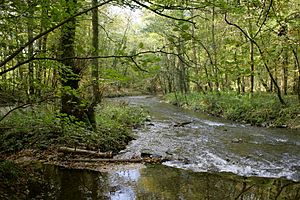
FFH area Dhünn and Eifgenbach
|
FFH area Dhünn and Eifgenbach
|
||
|
The Eifgenbach flows into the Dhünn |
||
| location | Leverkusen , Rheinisch-Bergischer Kreis , North Rhine- Westphalia , Germany | |
| surface | 285.94 hectares | |
| Identifier | DE-4809-301 | |
| WDPA ID | 555520149 | |
| Natura 2000 ID | DE4809301 | |
| Geographical location | 51 ° 4 ' N , 7 ° 8' E | |
|
|
||
| Setup date | November 1999 | |
The FFH area Dhünn and Eifgenbach is a 285 hectare large Natura 2000 -type region in North Rhine-Westphalia . It includes a nature reserve in the city of Leverkusen , as well as several nature reserves in Bergisch Gladbach , Odenthal , Burscheid and Wermelskirchen in the Rheinisch-Bergisch district . The Natura 2000 area is registered in accordance with Directive 92/43 / EEC (Fauna-Flora-Habitat Directive) with the FFH area report DE-4809-301 under the name “Dhünn and Eifgenbach”.
description
The FFH area extends through the Dhünntal below the Great Dhünntalsperre near Kochshof to Wiesdorf and through the Eifgenbachtal from Finkenholler Mühle south of Wermelskirchen to the confluence with the Dhünn near Altenberg / Blecher .
Below the dam shape alder - and ash - riparian forests , chickweed Oak hornbeam forests and grassland areas in the flood plain along with Book - oaks -Hangwäldern the image of the river valley. The hillside forests reach down to the Dhünn and, after the Eifgenbach flows into it, the floodplain, which has agricultural uses here, opens up. Small-scale floodplain forests follow that accompany the river. At Altenberg and Odenthal, recreational and residential areas border the river. Overall, the Dhünn is close to nature and has bed and bank structures that provide habitats for the bullhead and the river lamprey , among others .
The kerbsohlental of the Eifgenbach , which is partially cut deep into the forests of the Bergische plateau , is characterized by locally extensively used and moist, rush-rich grassland and by species-rich alder and alder- ash forests that accompany the stream . Smaller spruce afforestations and fish ponds in the floodplain impair the otherwise natural landscape.
Habitats of common interest
- Running waters with underwater vegetation (3260)
- Moist tall herbaceous corridors (6430)
- Hainsimsen-Buchenwald (9110)
- Alder-ash and softwood alluvial forests (91E0, priority habitat)
- English oak- hornbeam forest (9160)
- Woodruff beech forest (9130)
Types of Community Interest
- Bullhead
- River lamprey
- Brook lamprey
- salmon
Desired protective measures
As part of the state-wide network of biotopes, the valley system represents a core area in the Bergisches Land nature park and is part of the Dhünn-Eifgenbach corridor, which creates the network between the two natural areas of Bergische Hochflächen and Bergische Heideterrassen . The maintenance and development of extensively used meadow valleys alternating with structurally richly structured alder-ash floodplain forests as well as near-natural forest management and the maintenance of the natural water balance of the star chickweed oak-hornbeam stocks should be the primary goal. The promotion of the fish fauna is to be sought by maintaining the near-natural river and stream sections. On the valley slopes, the careful conversion of the forest to near-natural grove beech forests as a supplement to existing beech forests is to be aimed for in order to initiate the development of a large, near-natural beech forest area. The negative effects on the area from spruce afforestation and the use of fish ponds in the valley or from leisure activities ( e.g. horse riding or mountain biking ) must be counteracted with suitable measures.
See also
- Nature reserve Dhünn (LEV-016)
- Nature reserve Dhünntal and Linnefetal with side valleys
- Nature reserve Dhünnaue (Middle Dhünn)
- Nature reserve Dhünnaue (southern district)
- Eifgenbach nature reserve and side valleys
Individual evidence
- ↑ a b c Natura 2000 area "Dhünn and Eifgenbach" in the specialist information system of the State Office for Nature, Environment and Consumer Protection in North Rhine-Westphalia , accessed on June 14, 2017.

