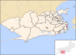
Flamengo
| Flamengo | |
|---|---|
| Coordinates | 22 ° 56 ′ 1 ″ S , 43 ° 10 ′ 28 ″ W |

|
|
| Basic data | |
| Country | Brazil |
| Rio de Janeiro | |
| city | Rio de Janeiro |
| ISO 3166-2 | BR-RJ |
| Sub-prefecture | Zona Sul |
| surface | 1.6 km² |
| Residents | 50,043 (2010) |
| density | 30,397.3 Ew. / km² |
Flamengo is a neighborhood in District IV Botafogo of Rio de Janeiro .
Flamengo is located between the city center ( Centro ) and Botafogo . At the beach there is a 1.2 km² park, the Parque do Flamengo , in which over 3000 species of trees have been planted. The park also has a view of Guanabara Bay .
Web links
Commons : Flamengo - collection of images, videos and audio files

