
Fuorcla Grevasalvas
| Fuorcla Grevasalvas | |||
|---|---|---|---|
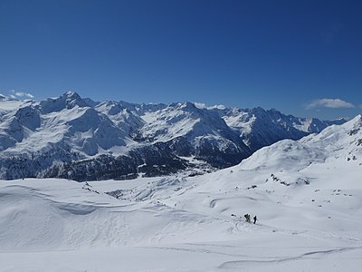
 Fuorcla Grevasalvas from the north. |
|||
| Compass direction | North | south | |
| Pass height | 2687 m above sea level M. | ||
| Canton | Graubünden , Switzerland | ||
| Watershed | Eva Cheda ( Gelgia , Albula , Hinterrhein , Rhine ) | Ova da la Roda ( Inn , Danube ) | |
| Valley locations | Julier Pass | Plaun da Lej | |
| expansion | trail | ||
| Mountains | Albula Alps | ||
| profile | |||
| Ø pitch | 11.3% (450 m / 3.98 km) | 14.6% (889 m / 6.1 km) | |
| Map (Graubünden) | |||
|
|||
| Coordinates | 774 754 / 145 556 | ||

The Fuorcla Grevasalvas ( Rhaeto-Romanic fuorcla, furschela from the Latin furcula for 'small fork, small mountain passage' and Grevasalvas a composition of the Rhaeto-Romanic words greva for 'fine scree', ' scree slope ' and alv from the Latin albus for 'white') is a Alpine pass in the Swiss canton of Graubünden . The pass with a peak height of 2687 m above sea level. M. is located south of the Julier Pass and north of Lake Sils .
Location and surroundings

The Fuorcla Grevasalvas belongs to the Lagrev group, a subgroup of the Albula Alps . The municipal boundary between Surses and Sils in Engadin / Segl runs over the pass . It is the only passage over the mountain range of any practical importance.
The Fuorcla Grevasalvas is bordered in the north by the Grevasalvas basin from the Oberhalbstein and in the south by the Upper Engadine and connects the Piz d'Emmat Dadaint ( 2928 m ) in the west with the Piz Lagrev ( 3162 m ) in the northeast.
With the same name as the pass, the small summer settlement Grevasalvas is located south of the pass . The 26-part children's series Heidi was produced in Grevasalvas in 1978 , which is based very closely on the novels Heidi's apprenticeship and wandering years and Heidi can use what it has learned from Johanna Spyri . In addition, north of Fuorcla Grevasalvas is the Leg Grevasalvas mountain lake in the Grevasalvas basin and the Piz Grevasalvas mountain ( 2932 m ) southeast of the pass .
The main European watershed runs over the pass, separating the inlet to the open Atlantic in the north (Eva Cheda, Gelgia , Albula , Hinterrhein , Rhein ) from the inlet to the Black Sea in the south (Ova da la Roda, Inn , Danube ).
Routes to the pass

Summer routes
Past Leg Grevasalvas
- Starting point: La Veduta on the Julier Pass road ( 2237 m )
- Via: Leg Grevasalvas ( 2390 m )
- Difficulty: B than trail white-red-white marks
- Time required: 1½ hours
Over the southern slope
- Starting point: Plaun da Lej ( 1799 m )
- Via: Grevasalvas ( 1941 m ), Plaun Grand
- Difficulty: B than trail white-red-white marks
- Time required: 3 hours
- Note: Fuorcla Grevasalvas can also be reached from other starting points between Maloja and Sils.
Winter routes
From la Veduta
- Starting point: La Veduta on the Julier Pass road ( 2237 m )
- Via: Leg Grevasalvas ( 2390 m )
- Exposures: N
- Difficulty: L
- Time required: 2 hours
From Plaun da Lej
- Starting point: Plaun da Lej ( 1799 m )
- Via: Grevasalvas ( 1941 m ), Plaun Grand
- Exposures: S, SE
- Difficulty: L +
- Time required: 3 hours
gallery

The south side of Fuorcla Grevasalvas, taken from Lake Sils . In the middle of the picture the Piz Lagrev , on the left the Fuorcla Grevasalvas and the Piz d'Emmat Dadaint , on the far left the Piz Materdell .

Leg Grevasalvas , behind it v. l. No. Piz Lagrev , Fuorcla Grevasalvas, Piz d'Emmat Dadaint , Fuorcla d'Emmat and Piz d'Emmat Dadora .
View in south direction on the western part of the Bernina Alps ( Piz da la Margna , Cima di Rosso , Cima di Castello , Piz Cengalo , Piz Badile ) and Maloja in the valley,


literature
- Manfred Hunziker: Club guide, Bündner Alps . From the Septimer to the Flüela. 3. Edition. Vi. Verlag des SAC, 2000, ISBN 3-85902-187-7 , p. 79-80 .
- Vital Eggenberger: Ski tours Graubünden South . Verlag des SAC, 2010, ISBN 978-3-85902-301-7 , pp. 154-158 .
- National map of Switzerland, sheet 1276 Val Bregaglia, 1: 25,000, Federal Office of Topography, 2015 edition.
- National map of Switzerland, sheet 1256 Bivio, 1: 25,000, Federal Office of Topography, 2015 edition.
Web links
Individual evidence
- ↑ Andrea Schorta: How the mountain got its name . Small Rhaetian name book with two and a half thousand geographical names of Graubünden. Terra Grischuna Verlag, Chur and Bottmingen / Basel 1988, ISBN 3-7298-1047-2 , p. 89 .
- ↑ Andrea Schorta: How the mountain got its name . Small Rhaetian name book with two and a half thousand geographical names of Graubünden. Terra Grischuna Verlag, Chur and Bottmingen / Basel 1988, ISBN 3-7298-1047-2 , p. 93 .
- ↑ Peter Dietmar: Congratulations: Heidi turns 125 . In: Die Welt , July 6, 2005. Retrieved March 10, 2014.
- ↑ About stick and stone ( Memento of the original from March 11, 2014 in the Internet Archive ) Info: The archive link was inserted automatically and has not yet been checked. Please check the original and archive link according to the instructions and then remove this notice. . In: SF bi de Lüt From: Schweizer Radio und Fernsehen , June 24, 2011. Accessed March 10, 2014.
- ^ Judith Mandelbaum-Schmid: Where Heidi Belongs . In: The New York Times, April 5, 1987. Retrieved March 10, 2014.