
Piz Grevasalvas
| Piz Grevasalvas | ||
|---|---|---|
 Piz Grevasalvas, taken from Lake Marmorera . |
||
| height | 2931 m above sea level M. | |
| location | Canton of Graubünden , Switzerland | |
| Mountains | Albula Alps | |
| Dominance | 1.9 km → Piz Materdell | |
| Notch height | 141 m ↓ ridge between Motta Radonda and Piz Materdell | |
| Coordinates | 771 853 / 143 731 | |
|
||
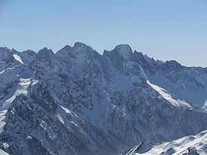
 Piz Lunghin in the clouds on the left, Piz Grevasalvas to the right of it, taken from Isola on the south side of Lake Sils . |
||

The Piz Grevasalvas ( composition of the Rhaeto-Romanic words greva for “fine scree”, “scree slope ” and alv from the Latin albus for “white”) is a mountain northwest of Maloja and southeast of Bivio in the canton of Graubünden in Switzerland with an altitude of 2931 m above sea level M. It is a popular ski touring mountain. South of Piz Grevasalvas is at 2484 m above sea level. M. the Lunghinsee , which is considered the source of the Inn . To the southeast is the main European watershed, Pass Lunghin . From Piz Grevasalvas you have a comprehensive view of the Upper Engadine and the Surgôt, the upper part of the Oberhalbstein .
Location and surroundings
The Piz Grevasalvas is at the back of the Oberhalbstein . It belongs to the Piz Lagrev group, a subgroup of the Albula Alps . The municipal boundaries between Sils in Engadin / Segl , Bregaglia and Surses meet at the summit . The Piz Grevasalvas is bordered in the southeast by the Upper Engadine and in the north by the Tgavretga (a little above Bivios that branches off the Julier route to the south ).
The neighboring peaks include the Piz Materdell and the Motta Radonda ( referred to as Piz Nalar in the SAC Club Guide) in the north-east and the Piz Lunghin and Piz dal Sasc in the south-west.
Valley locations are Bivio and Maloja. A frequent starting point is Plaun da Lej on Lake Sils .
particularities
Lunghin Pass watershed
Southwest of Piz Grevasalvas is the Lunghin Pass ( 2645 m above sea level ), the most important watershed point in Central and Western Europe, as the watershed between the three largest seas that surround Europe meet here ( European main watershed ). The water flows northwards via Gelgia / Julia and Rhine to the North Sea / Atlantic , southwards via Maira / Mera and Po into the Mediterranean and eastwards via Inn and Danube into the Black Sea .
«Heididorf» Grevasalvas

To the east of Piz Grevasalvas is the small summer settlement Grevasalvas . The 26-part children's series Heidi was produced in Grevasalvas in 1978 , which is based very closely on the novels Heidi's apprenticeship and wandering years and Heidi can use what it has learned from Johanna Spyri .
Routes to the summit
The Piz Grevasalvas rises directly above the Lunghinsee and slopes down towards it in several rock steps lying one above the other. The east side is flattened and easy to climb.
Summer routes
From the east
- Starting point: Plaun da Lej ( Sils in the Engadin , 1799 m )
- Via: Grevasalvas summer settlement, Plaun Grand, Lej Nair
- Difficulty: L , as a trail white-red-white highlighted
- Time required: 4 hours
Over the southeast ridge
Nice climbing spots on relatively good rock, you can switch to the slab area on the eastern slope at will.
- Starting point: Maloja ( 1809 m ) or Plaun da Lej ( 1799 m )
- Via: Saddle P. 2550
- From Maloja via Lunghinsee to the saddle P.2550
- From Plaun da Lej via Grevasalvas, Plaun Grand, direction Lunghinsee to the saddle P.2550
- 4–6 hours from Maloja (depending on route choice)
- 4¼ – 6¼ hours from Plaun da Lej (depending on route choice)
- Alternative: Climbing the first twin tower ( 2740 m ) of the ridge is often a solo climb (difficulty S , IV + ).
Over the southwest ridge
- Starting point: Maloja ( 1809 m ), Casaccia ( 1458 m ), Bivio ( 1769 m ) or Juf ( 2117 m )
- Via: Pass Lunghin ( 2645 m )
- From Maloja via Lunghinsee, Pass Lunghin
- From Casaccia via Val Maroz, Septimerpass ( 2310 m ), Pass Lunghin
- From Casaccia the Septimerweg to P1839.2, Alpascela, Alpascelin, Pass Lunghin
- From Bivio via Tgavretga, Septimerpass, Pass Lunghin
- From Juf via Forcellina ( 2672 m ), Septimerpass, Pass Lunghin
- Difficulty: L
- Time required:
- 3¾ hours from Maloja
- 5¼ hours from Casaccia via Septimerpass
- 5¼ hours from Casaccia via Alpascelin
- 4½ hours from Bivio
- 5¼ hours from Juf
- Note: Marked as a white-red-white hiking trail up to Pass Lunghin
Winter routes
A particularly rewarding tour in spring.
From the Julier Pass
- Starting point: La Veduta (west of the Julier Pass , 2237.9 m )
- Via: Leg Grevasalvas , Fuorcla Grevasalvas 2688 m
- Exposures: N, SE
- Difficulty: WS
- Time required: 4½ hours
- Note: Long ascent with a lot of flat sections, not suitable as a descent because of the 2–3 counter-slopes.
From Plaun da Lej
|
.jpg)
From Bivio
- Starting point: Bivio ( 1769 m )
- Via: Tgavretga, Fumia, clockwise around Bleis Lunga to P. 2623, to the northeast ridge of Piz Grevasalvas
- Exposures: N, NW
- Difficulty: ZS
- Time required: 4 hours
- Alternative: As a descent from P.2623 you can also cross to the left into the slope
- Note: only under safe conditions (35 ° steep at 200 m)
panorama

gallery

View to the west into the Upper Engadine .

View to the north to the Surgôt (upper part of the Oberhalbstein ), behind the Lenzerheide .

View to the southeast to Maloja .

View to the south to Lake Albigna .

View of the Bernina group .
View to Piz Badile .

View to Piz Platta , Piz Forbesch and Piz Arblatsch (from left to right).


literature
- Eugen Wenzel, Paul Gross: Club Guide, Graubünden Alps, Volume VI (Albula). 2nd Edition. Verlag des SAC, 1980, ISBN 3-85902-012-9 , p. 35.
- Manfred Hunziker: Club Guide, Bündner Alpen, Volume VI (From Septimer to Flüela). 3. Edition. Verlag des SAC, 2000, ISBN 3-85902-187-7 , pp. 68-70.
- Vital Eggenberger: Ski tours Graubünden South. Verlag des SAC, 2010, ISBN 978-3-85902-301-7 , pp. 156-158.
- National map of Switzerland, sheet 1276 Val Bregaglia, 1: 25000, Federal Office of Topography, edition 2001.
- National map of Switzerland, sheet 268S Julierpass, 1: 50000, Federal Office of Topography, edition 2001.
Web links
- Panorama from Piz Grevasalvas
- Tour reports on www.hikr.org
- Piz Grevasalvas on the ETHorama platform
Individual evidence
- ↑ Andrea Schorta: How the mountain got its name . Small Rhaetian name book with two and a half thousand geographical names of Graubünden. Terra Grischuna Verlag, Chur and Bottmingen / Basel 1988, ISBN 3-7298-1047-2 , p. 93 .
- ↑ Peter Dietmar: Congratulations: Heidi turns 125 . In: Die Welt , July 6, 2005. Retrieved March 10, 2014.
- ↑ About stick and stone ( Memento of the original from March 11, 2014 in the Internet Archive ) Info: The archive link was inserted automatically and has not yet been checked. Please check the original and archive link according to the instructions and then remove this notice. . In: SF bi de Lüt From: Schweizer Radio und Fernsehen , June 24, 2011. Accessed March 10, 2014.
- ^ Judith Mandelbaum-Schmid: Where Heidi Belongs . In: The New York Times, April 5, 1987. Retrieved March 10, 2014.