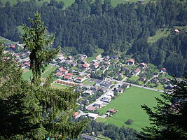
Gantschier
|
Gantschier ( village ) locality |
||
|---|---|---|
|
|
||
| Basic data | ||
| Pole. District , state | Bludenz (BL), Vorarlberg | |
| Judicial district | Bludenz | |
| Pole. local community | Bartholomäberg | |
| Coordinates | 47 ° 5 '21 " N , 9 ° 53' 8" E | |
| height | 640 m above sea level A. | |
| Residents of the village | 9 (January 1, 2020) | |
| Building status | 194 (2001) | |
| Postcodes | 6780 Schruns , 6771 St. Anton , 6773 Vandans | |
| Statistical identification | ||
| Locality code | 17062 | |
| Counting district / district | Gantschier (80 101 001) | |
 The place Gantschier from Latschau from |
||
| Source: STAT : index of places ; BEV : GEONAM ; VoGIS | ||
Gantschier is a village in the Montafon in Vorarlberg , and a locality of Bartholomäberg in the Bludenz district .
geography
The village is out of the valley, northwest of Schruns , in the valley floor of the Ill , at the foot of the Itonskopf ( 2089 m above sea level ), a summit of the western Verwall ( Itonskopfgruppe ). The town center lies on the alluvial cone of the Fritzenbach (Fretza).
The village also includes Auserböden out of the valley, the houses across from Innervens and Daleu , and the settlement of Kaltenbrunnen across from Schruns into the valley, which is already largely in the Schruns area.
In the northwest of the village lies Stretch Red Stone (after the shape Hosensee called ▼ ), which was created for the lowering of the water table and now a fishing area and bathing water is. There is also the settlement of the same name.
On the other side of the Ill are the three Rodund basins , the floodlights of the Latschau reservoir of the illwerke vkw .
Neighboring places:
| Outdoor floors | Lutt | Worms |
| Innerbach (Gem. Vandans ) |

|
Bartholomäberg Montjola (Gem. Schruns) |
| Krista (Gem. Tschagguns ) | Schruns |
history
The place name goes back to Romansh cuntschier , documented in 1380, meaning a damp settlement in the Au . Originally there was only a scattered settlement a little higher on the mountain edge and was only built on the plain in the post-war period, when the Fritzentobel was elaborately built. From 1949 to 1950, Vorarlberger Illwerke constructed the first ten houses in the Kaltenbrunnen housing estate, and by 1952 another 15 buildings, including a fire station. In 1958, a new elementary school with a kindergarten and until 1964 the Gantschier parish exposition church was built. The music house followed in 1973, and later a building of the spark guild next to it. In addition to the music house, a polytechnic school was also built, which is used by students from several communities in the valley. Today the place has over 150 buildings. In 2013 the parish exposition was elevated to the 126th parish of the diocese of Feldkirch and at the same time the new organ was inaugurated.
literature
- Zita Bernardi: Development of the history of Gantschier . The development from a rural settlement to an industrial and tourist location. 1978 ( tk-gantschier.at [PDF]).
Web links
- Trachtenverein Gantschier Montafon , tk-gantschier.at
Individual evidence
- 41304 - Bartholomäberg. Community data, Statistics Austria .
- ↑ Photo of the Hosensee ( page no longer available , search in web archives ) Info: The link was automatically marked as defective. Please check the link according to the instructions and then remove this notice. , woss.at, accessed May 4, 2009
- ↑ Red Stone ( Memento of the original from September 19, 2011 in the Internet Archive ) Info: The archive link was inserted automatically and has not yet been checked. Please check the original and archive link according to the instructions and then remove this notice. , Illwerke Sportfischereiverein, illwerkefischer.at
- ↑ a b Lit. Bernardi: 1978, p. 1
- ↑ orf.at - Gantschier becomes its own parish
