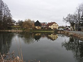
Gleima
|
Gleima
community Remptendorf
Coordinates: 50 ° 31 '43 " N , 11 ° 31' 45" E
|
|
|---|---|
| Height : | 572 m above sea level NN |
| Incorporation : | September 2, 1995 |
| Incorporated into: | Gahma |
| Postal code : | 07368 |
| Area code : | 036643 |
|
In the town
|
|
Gleima is a settlement in the municipality of Remptendorf in the Saale-Orla district in Thuringia .
geography
Gleima is located on a high plateau of the Southeast Thuringian Slate Mountains that slopes towards the Sormitztal . The corridor is flanked by wooded hills to the east and wooded slopes to the west. In the valley of the Sormitz the federal road 90 and on the plateau of Gleima parallel the state road 1099, which then connects further north to the federal road 90.
history
Gleima was first mentioned on April 30, 1417. The place was until 1918 in the Leutenberg area of the sovereignty of the Principality of Schwarzburg-Rudolstadt .
On September 2, 1995 Gleima was incorporated into Gahma .
Web links
Commons : Gleima - collection of images, videos and audio files
Individual evidence
- ^ Wolfgang Kahl : First mention of Thuringian towns and villages. A manual. 5th, improved and considerably enlarged edition. Rockstuhl, Bad Langensalza 2010, ISBN 978-3-86777-202-0 , p. 90.
