Gmina Żukowo
| Gmina Żukowo | ||
|---|---|---|

|
|
|
| Basic data | ||
| State : | Poland | |
| Voivodeship : | Pomerania | |
| Powiat : | Powiat Kartuski | |
| Geographic location : | 54 ° 21 ' N , 18 ° 22' E | |
| Residents : | s. Gmina | |
| Postal code : | 83-330 | |
| Telephone code : | (+48) 58 | |
| License plate : | GKA | |
| Economy and Transport | ||
| Street : | DK 7 : → Warsaw - Chyżne / Slovakia | |
| DK 20 : Stargard - Szczecinek - Gdynia | ||
| Ext. 211 : → Kartuzy - Nowa Dąbrowa | ||
| Rail route : | PKP line 201: Nowa Wieś Wielka - Gdynia | |
| PKP line 229: Pruszcz Gdański - Lębork - Łeba | ||
| Next international airport : | Danzig | |
| Gmina | ||
| Gminatype: | Urban-and-rural parish | |
| Gmina structure: | 32 localities | |
| 22 school authorities | ||
| Surface: | 163.95 km² | |
| Residents: | 39,899 (Jun. 30, 2019) |
|
| Population density : | 243 inhabitants / km² | |
| Community number ( GUS ): | 2205083 | |
| Administration (as of 2014) | ||
| Mayor : | Wojciech Kankowski | |
| Address: | ul.Gdańska 52 83-330 Żukowo |
|
| Website : | www.zukowo.pl | |
The Gmina Żukowo is an urban-and-rural municipality in the powiat Kartuski of the Pomeranian Voivodeship in Poland . The municipality has an area of nearly 164 square kilometers and about 35,500 inhabitants. Its seat is the city of Żukowo ( German Zuckau , kashb. Żukòwò , Latin Sucovia ) with 6567 inhabitants (2016).
geography
The municipality is located in the former West Prussia in the east of the lake-rich Kashubian Switzerland on the Radunia River (Radaune) .
In 1973, the village of Rębiechowo ceded parts of its area to the city of Gdansk, today they are part of the Lech Walesa Airport Gdansk .
history
The area of the municipality belonged to the Polish Pomeranian Voivodeship from 1920 to 1939 .
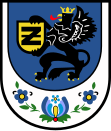
From 1975 to 1998 the municipality was part of the Gdansk Voivodeship . Żukowo received city rights in 1989. In Gemeukowo's municipal coat of arms, next to the Pomeranian griffin, there is a palmette made of Kashubian embroidery.
structure
In addition to the city of Żukowo, the urban and rural community Gemeindeukowo includes 22 villages (German names up to 1945) with a Schulzenamt:
- Babi Dół ( Babenthal )
- Banino ( Banin )
- Borkowo ( Borkau )
- Chwaszczyno ( Quashin )
- Czaple ( Czapel )
- Glincz ( Glintsch )
- Leźno ( reading )
- Łapino Kartuskie ( Lappin )
- Małkowo ( Mahlkau )
- Miszewo ( Gross Mischau )
- Niestępowo ( Nestempohl )
- Nowy Świat ( New World )
- Otomino ( Ottomin )
- Pępowo ( Pempau )
- Przyjaźń ( Rheinfeld )
- Rębiechowo ( Ramkau )
- Rutki ( Ruthken )
- Skrzeszewo Żukowskie ( Krissau )
- Sulmin ( Richthof )
- Tuchom ( Great Tuchom )
- Widlino ( Fidlin )
- Żukowo-Wieś (-)
Other localities in the municipality are: Barniewice, Borowiec, Dąbrowa, Elżbietowo ( Elisenhof ), Lniska, Miszewko, Nowy Tuchom, Piaski and Stara Piła ( Altemühle ).
traffic
In Żukowo the national roads 7 , 20 and the voivodship road 211 intersect .
Web links
Footnotes
- ↑ population. Size and Structure by Territorial Division. As of June 30, 2019. Główny Urząd Statystyczny (GUS) (PDF files; 0.99 MiB), accessed December 24, 2019 .
- ↑ The Historical Place Directory


